Претрага
468 items
-
Strain partitioning in a large intracontinental strike-slip system accommodating backarc-convex orocline formation: The Circum-Moesian Fault System of the Carpatho-Balkanides
Nemanja Krstekanić, Liviu Matenco, Uroš Stojadinović, Ernst Willingshofer, Marinko Toljić, Daan Tamminga (2022)oroklini, raspodela deformacija, transkurentna kretanja, Karpato-balkanidi, Cirkum-mezijski rasedni sistem... partitioning in our study area and to discuss potential mechanisms driving the formation of the backarc-convex Carpatho-Balkanides oro- cline. Because the formation of this backarc-convex orocline is rather unique during the Alpine evolution of the entire Mediterranean area (see Fig. 1), the results ...
... opening of the Žagubica Basin north of the studied area (Fig. 2). However, normal faults controlling this basin do not demonstrate clear map-scale interaction with dextral strike-slip faults because to the north and northwest of our studied area strike- slip deformation is distributed and rarely ...
... studied area of the Serbian Carpathians, this system experienced partitioning of the major dextral deformation into laterally continuous structures with different, orogen-parallel extension and thrusting kinematics. This type of strain partitioning can be corre- lated at a more regional area including ...Nemanja Krstekanić, Liviu Matenco, Uroš Stojadinović, Ernst Willingshofer, Marinko Toljić, Daan Tamminga. "Strain partitioning in a large intracontinental strike-slip system accommodating backarc-convex orocline formation: The Circum-Moesian Fault System of the Carpatho-Balkanides" in Global and Planetary Change, Elsevier BV (2022). https://doi.org/10.1016/j.gloplacha.2021.103714
-
Mapping and classifying large deformation from digital imagery: application to analogue models of lithosphere deformation
kontinentalna tektonika: kompresija, kontinentalna tektonika: ekstenzija, kontinentalna tektonika: transkurentni i transformni rasedi, pukotine, rasedi, zone snažnih deformacija, kinematika deformacija kore i omotača, teorijska mehanika, modelovanje... of the model (64 min). Left-hand panel: strain type. Right-hand panel: dilation (relative area change). A dilatation >1 indicates an area increase (extension/transtension) and a dilatation <1 indicates an area decrease (shortening/transpression), it is insensitive to pure strike-slip. 5.5 Time evolution ...
... the extensional strain limit of –1. The grey area depicts physically impossible values (Section 2.2). Right upper-hand panel: the maximum shear gives the same values for γ max = ǫ1 − ǫ2 (infinitesimal) or γ max = λ1 − λ2 (finite). Left lower-hand panel: area change in terms of dilatation (eq. 5). Dilatation ...
... end-members: (a) isotropic area increase: ǫmax = ǫmin and ǫmax > 0 and ǫmin > 0, (b) uniaxial extension: ǫmax > 0 and ǫmin = 0, (c) strike-slip (simple shear): |ǫmax| = |ǫmin| and ǫmax > 0 and sign(ǫmax) = −sign(ǫmin), (d) uniaxial shortening: ǫmax < 0 and ǫmin = 0 (e) isotropic area decrease: ǫmax = ǫmin ...Taco Broerse, Nemanja Krstekanić, Cor Kasbergen, Ernst Willingshofer. "Mapping and classifying large deformation from digital imagery: application to analogue models of lithosphere deformation" in Geophysical Journal International, Oxford University Press (OUP) (2021). https://doi.org/10.1093/gji/ggab120
-
Structural characterization of traditional pottery produced from local clay, Rujište (Ražanj, Central Serbia), in an effort to preserve its geoheritage
... Raw clay, from which investigated sample of pottery was produced, largely falls under Neogene sediments which are extensive in the area of Ražanj. Investigated area, according to the geological map, is abundant in sediments that are composed of microcrystalline carbonate which is intimately mixed ...
... analysis of the clay body used in the manufacture of traditional pottery, bread-baking pan called crepulja, prepared with raw local clays from Ražanj area in western Serbia, without any additional tempers added. Pottery manufacture with these specific raw materials and the final function of the product ...Maja Milošević, Biljana Đorđević, Alena Zdravković . "Structural characterization of traditional pottery produced from local clay, Rujište (Ražanj, Central Serbia), in an effort to preserve its geoheritage" in 9th International Conference Mineralogy and Museums, Sofia, Bulgaria, Earth and Man National Museum and Bulgarian Mineralogical Society (2021)
-
Towards Better Valorisation of Industrial Minerals andRocks in Serbia—Case Study of Industrial Clays
... most cases, it is quite enough. However, the area for geological ex- ploration is limited to a maximum of two square kilometres, which is often not enough for new potential targets, and requires investors to submit several exploration projects in the same area for the same mineral commodity. It would be ...
... municipal authorities may ask for a de- tailed regulation plan, particularly if the exploration target is close to some category of protected area or vulnerable area (water courses and vicinity of populated areas). The total procedure to obtain all permits related to exploration is usually 1–6 months depend- ...
... depends on the state authorities. Contrary to that, the enhancement of geological exploration methodology should be the issue of experts working in that area of the mining industry but is also very much related to the existing legislation. Serbia still has very strictly prescribed procedures, which are gen- ...Vladimir Simić, Dragana Životić, Zoran Miladinović. "Towards Better Valorisation of Industrial Minerals andRocks in Serbia—Case Study of Industrial Clays" in Resources, MDPI AG (2021). https://doi.org/10.3390/resources10060063
-
Razvoj ARCGIS geobaze površinskog kopa korišćenjem UML CASE alata
... queries such as: “Which boreholes are at a distance of 50 meters from the L1 profile line?”, “Which objects are in the area planned for exploitation in 2016?“, „Which boreholes are in the area that is to be excavated by the end of the year?“ and the like. Namely, relations between objects ...
... the state of mining objects, works on mine benches coal and waste dumps. The application of GIS is especially important in the environment protection area, as it enables active monitoring of the impact of mining operations to environment: air, water and soil quality, determination of the level of risk ...
... between Busotina and Analiza classes 5 Class diagram Objekti (Figure 4) models natural and infrastructural objects within the exploitation area. Having in mind that these objects are often displaced with the development of the pit, the class StanjeRadova has been introduced, which models their ...Aleksandra Tomašević, Ljiljana Kolonja, Ivan Obradović, Ranka Stanković, Olivera Kitanović. "Razvoj ARCGIS geobaze površinskog kopa korišćenjem UML CASE alata" in Podzemni radovi, Beograd : Univerzitet u Beogradu - Rudarsko-geološki fakultet (2012)
-

Assessments of effects of implementation of strategic plans for development of Belgrade District heating system
The district heating system (DHS) is one of the key elements of the Belgrade energy system. Overview of the current state and basic characteristics of the DHS are presented in this paper. The focus is on the planned development of DHS and on the analyses of effects of realization of measures and projects defined by strategic documents related to DHS which are adopted by city authorities (Development Strategy of DHS and Strategy of Belgrade Development). Two exploratory scenarios were ...Dejan Ivezić, Marija Živković, Aleksandar Madžarević, Miodrag Grujić. "Assessments of effects of implementation of strategic plans for development of Belgrade District heating system" in Sustainable Cities and Society, Elsevier BV (2020). https://doi.org/10.1016/j.scs.2020.102304
-

Upotreba lidar tehnologije i digitalne fotogrametrije primenom iPhone pametnih telefona na primeru rudnika "Rudnik"
Nikola Mirković, Luka Crnogorac, Aleksa Paunović. "Upotreba lidar tehnologije i digitalne fotogrametrije primenom iPhone pametnih telefona na primeru rudnika "Rudnik"" in 15. Simpozijum „Rudarstvo 2024“ Održivi razvoj u rudarstvu i energetici, Vrnjačka banja, 21-24. maj 2024., Beograd : Institut za tehnologiju nuklearnih i drugih mineralnih sirovina (2024)
-
Application of a Method for Intelligent Multi-Criteria Analysis of the Environmental Impact of Tailing Ponds in Northern Kosovo and Metohija
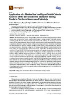
Gordana Milentijević, Blagoje Nedeljković, Milena Lekić, Zoran Nikić, Ivica Ristović, Jelena Đokić (2016)... longer any dumping of waste. 2. Study Area The study area is situated on the large highland Kosovo, to the north of the Autonomous Region Kosovo and Metohija (Figure 1). Administratively, it belongs to the municipalities of Zvečan and Kosovska Mitrovica. The study area has the typical continental climate ...
... the area as well as those from remote areas are highly endangered by the Energies 2016, 9, 935 3 of 18 leaching contamination from the tailings. The characteristics of the analyzed flotation tailing waste deposits are shown in Table 1. ● đ đ Figure 1. Schematic review of the study area. —Tailing ...
... researchers deliberating different problems. In the field of mining, such researchers include Bogdanović et al. 2012 and Ataei et al. 2008 and in the area of environmental protection, Kiker et al. 2005 among others [7–9]. In this paper, analysis includes five non-remediated flotation tailings. On all ...Gordana Milentijević, Blagoje Nedeljković, Milena Lekić, Zoran Nikić, Ivica Ristović, Jelena Đokić. "Application of a Method for Intelligent Multi-Criteria Analysis of the Environmental Impact of Tailing Ponds in Northern Kosovo and Metohija" in Energies, MDPI AG (2016). https://doi.org/10.3390/en9110935
-
Using gravity data to define structural correlation affecting the formation of Neogene basins
A gravity survey can help to define the structural correlation in the study area. The structures that have influenced the development of Neogene basins can be defined using gravity data. By applying mathematical transformations to gravity data, the geological structures (faults, nappes, etc.) that impacted the formation of Neogene basins can be defined. We have taken the part of the Dinarides as the test region. The paper presents the results obtained using the procedure residual, vertical gradient, and total ...Snežana Ignjatović, Ivana Vasiljević, Branisav Sretković, Milanka Negovanović. "Using gravity data to define structural correlation affecting the formation of Neogene basins" in The 54th International October Conference on Mining and Metallurgy, Bor Lake, Serbia, 18-21 October 2023, Bor : University of Belgrade, Technical Faculty in Bor (2023)
-
2D geoelectrical resistivity tomography application at the former city waste dump "Ada Huja": Eco-geological problem
... trend is maintained. Figure 10b shows the real area of the surveyed terrain and Figure 10a shows the cadastre plots of the terrain. Figure 10 Maps: a) Location of cadastre plots (National Spatial Data Infrastructure, 2019) and b) the real area of the surveyed terrain (Google Earth) Table contents ...
... method; Wenner array; ecology; Ada Huja 1 INTRODUCTION The location of the former city waste dump “Ada Huja” was labeled as IBA (Important Bird Area), where refuge was found by some endangered species of birds like the black- headed seagull, big and small cormorant and the white-tailed eagle. Ada ...
... people, but also for the condition of the environment in general. This is best noticed in the completely wrong classification of forest classes in that area. Lateral resistivity changes in the disposed waste were detected using 2D geoelectrical scanning method along three profile lines. The chosen Wenner ...Branislav Sretenović, Filip Arnaut, Ivana Vasiljević, Vesna Cvetkov. "2D geoelectrical resistivity tomography application at the former city waste dump "Ada Huja": Eco-geological problem" in Podzemni radovi, Centre for Evaluation in Education and Science (CEON/CEES) (2019). https://doi.org/10.5937/PodRad1934059S
-

Application of Project Management Process on Environmental Management System Improvement in Mining-Energy Complexes
... location of the mine in relation to the catchment area A2 Irregular treatment of mine waters Discharge of untreated waste process water Occupation of large tracts of land Increasing the surface area of permanently destroyed area A3 Increasing the surface area of the buried humus layer Emissions ...
... location of the mine in relation to the catchment area A2Irregular treatment of mine waters Discharge of untreated waste process water Occupation of large tracts of land Increasing the surface area of permanently destroyed area A3Increasing the surface area of the buried humus layer Emissions of ...
... dispersal into the surrounding soil 5 2 1 + 0 + 0 + 1 + 0 + 1 30 4 Unfavorable location of the mine in relation to the catchment area 5 1 1 + 0 + 1 + 0 + 0 + 1 15 5 Larger permanently destroyed area 2 3 1 + 1 + 1 + 1 + 1 + 1 36 6 Irregular treatment of mine waters 5 3 1 + 0 + 1 + 1 + 0 + 1 60 7 Improper tailings ...Jelena Malenović Nikolić, Dejan Vasović , Ivana Filipović , Stevan Mušicki, Ivica Ristović . "Application of Project Management Process on Environmental Management System Improvement in Mining-Energy Complexes" in Energies (2016). https://doi.org/https://doi.org/10.3390/en9121071
-
Fuzzy optimization in hydrodynamic analysis of groundwater control systems: Case study of the pumping station “Bezdan 1”, Serbia
Dragoljub Bajić, Dušan Polomčić (2014)A groundwater control system was designed to lower the water table and allow the pumping sta-tion “Bezdan 1” to be built. Based on a hydrodynamic analysis that suggested three alternative solutions, mul-ticriteria optimization was applied to select the best alternative. The fuzzy analytic hierarchy process methodwas used, based on triangular fuzzy numbers. An assessment of the various factors that influenced the selec-tion of the best alternative, as well as fuzzy optimization calculations, yielded the “weights” of the alternativesand the ...groundwater lowering, groundwater management scenario, fuzzy analytic hierarchy process,expert knowledge, triangular fuzzy numbers, linguistic variables... above, the one devised by CHANG (1996) was used to arrive at the best alterna- tive for the groundwater control system of the “Be- zdan 1” PS. Study Area To prevent an environmental disaster in the Bačka District (Serbia), as well as avoid suspensions of nav- igation and different types of water supply ...
... addresses the “Bezdan 1” PS, located in the Town of Bezdan in northwestern Bačka. Figure 1 shows the geographical position and microlocation of the study area. Predictive Hydrodynamic Analysis The site of the future “Bezdan 1” PS features high groundwater levels, which directly affect the feasibil- ity ...
... below the excavation for the “Bezdan 1” PS, were defined as follows: • Alternative 1 (A1): Long-term average stages of the canals within the study area (Baračka Canal 82.80 m above sea level and Bezdan–Vrbas Canal 84.80 m.a.s.l.) were used in the predictive hydro- dynamic analysis. The groundwater control ...Dragoljub Bajić, Dušan Polomčić. "Fuzzy optimization in hydrodynamic analysis of groundwater control systems: Case study of the pumping station “Bezdan 1”, Serbia" in Geološki anali Balkanskoga poluostrva, Belgrade : University of Belgrade - Faculty of mining and geology (2014). https://doi.org/10.2298/GABP1475103B
-
Extreme Rainfall Event and Its Aftermath Analysis—IPL 210 Project Progress Report
Biljana Abolmasov, Mileva Samardžić Petrović, Ranka Stanković, Miloš Marjanović, Jelka Krušić, Uroš Đurić (2021)Biljana Abolmasov, Mileva Samardžić Petrović, Ranka Stanković, Miloš Marjanović, Jelka Krušić, Uroš Đurić. "Extreme Rainfall Event and Its Aftermath Analysis—IPL 210 Project Progress Report" in Understanding and Reducing Landslide Disaster Risk, Springer International Publishing (2021). https://doi.org/10.1007%2F978-3-030-60196-6_19
-
Definisanje strukturnih odnosa primenom postupka horizontalni gradijent
Različiti postupci matematičkih transformacija se mogu primeniti na gravimetrijskim i magne tometrijskim podacima, kako bi se na istražnom terenu definisali strukturno-tektonski odnosi. U radu su prikazani rezultati dobijeni korišćenjem postupka horizontalni gradijent i ukupni horizontalni gradijent na gravimetrisjkim podacima. Navedeni postupci su pomogli da se detektuju kontakti sa velikim padnim uglom (vertikalni ili subvertikalni kontakti), koji se mogu interpretirati kao rasedi. Za test područije uzet je istražni prostor koji se nalazi na jugoistoku Srbije u okolini Vranjskog basena. Položaji ...... subvertical contacts), which can be interpreted as faults. For the test area we take the study area located in southeast Serbia around Vranje basin. The positions of neotectonics faults detected during geological survey in the area of the Vranje basin partially coincides with contact obtained using ...
... methods of mathematical transformation can be applied on magnetic and gravity data, in order to define structural and tectonic correlation in study area. In this paper we present the results obtained using the technique of the horizontal gradient and the total horizontal gradient on gravity data. ...Snežana Ignjatović, Ivana Vasiljević, Natalija Jovanović. "Definisanje strukturnih odnosa primenom postupka horizontalni gradijent" in Tehnika, Beograd : Savez inženjera i tehničara Srbije (2019). https://doi.org/10.5937/tehnika1905664I
-
Projection of SO2 emissions in coal power plants in Serbia
Aleksandar Madžarević, Predrag Jovančić, Stevan Đenadić, Filip Miletić, Miodrag Ristović, Miroslav Crnogorac (2023)The production of electricity in the countries of South-Eastern Europe (SEE) was mainly related to the use of coal, predominantly lignite. The total installed capacity of thermal power plants using coal in these seven countries is 17.813 MW, distributed in 31 thermoblocks. The mentioned plants are the dominant pollutant emitters in all observed countries. Data on the largest emitters in the countries of the European Union and a comparison with SEE countries were collected. The calculation of emissions of ...... change in energy sources, so the process of removing coal from clectricity generation has greatly intensified. In 2021, for the first time in the area of the European Union, more electricity was generated using solar and wind energy than coal. The idea of using the cleanest technologies has completely ...
... emissions from coal-fired power plants in Germany, Poland and Serbia [5, 11} Emissions Parameter Amount of emission [tons] 279200 102470 Ratio to the area of the territory [SO>»/km-] 3,15 0,33 Ratio to the number of inhabitants [kgSOyx/st] 40,88 1,23 Ratio to electricity production [keSOx/MWh] 11,63 ...
... limit. 4. CONCLUSION Air pollution from coal-fired thermal power plants knows no national borders. Through the paper, it was pointed out that the area of Southeastern Europe represents a region that is among the largest emitters of pollutants from coal burning. Therefore, it is extremely important ...Aleksandar Madžarević, Predrag Jovančić, Stevan Đenadić, Filip Miletić, Miodrag Ristović, Miroslav Crnogorac. "Projection of SO2 emissions in coal power plants in Serbia" in 9th International Conference Mining and environmental protection, Sokobanja 24-27th May 2023., Belgrade : University of Belgrade, Faculty of Mining and Geology (2023)
-
Utilizing sewage wastewater heat in district heating systems in Serbia: effects on sustainability
Marija Živković, Dejan Ivezić (2021)Transformation of the heating sector is recognized as being essential for ensuring reliable and afordable energy services provided with reduced consumption of energy sources and diminished impact on the environment and less import dependency. The possibility of utilizing energy sources that otherwise would be wasted needs to be considered and treated as a big advantage of district heating systems. Despite many advantages, sewage wastewater heat is still a mostly unused resource at the global level and a totally unused ...рекуперација топлоте из отпадних вода, систем даљинског грејања, топлотне пумпе, енергетске уштеде, емисија угљендиоксида, енергетска безбедност, Србија... electricity production Qdel,j Delivered heat to the jth consumer qDD Useful annual heat supplied per degree day and heating area DD Number of degree days Ai Heating area of the ith consumer Id Import dependency pi Fraction of the ith input energy carrier/fuel in the fuel mix ( ∑ pi = 1) Id ...
... jth consumer, DD [ ∕ ] Number of degree days, A i [ m 2 ] Heating area of the ith consumer. In the approach adopted in this research, the value of use- ful annual heat supply per degree day and per heating area remains as the current value, providing a straightforward evaluation of the ...
... for analysis focusing on district heating systems’ energy performance (primary energy factor, specific heat consumption per degree day and heating area), the security of energy supply (import dependency, Shannon–Wiener diversification index, the share of renewables) and environmental impact (carbon ...Marija Živković, Dejan Ivezić. "Utilizing sewage wastewater heat in district heating systems in Serbia: effects on sustainability" in Clean Technologies and Environmental Policy, Springer Science and Business Media LLC (2021). https://doi.org/10.1007/s10098-021-02063-6
-
Results of comprehensive monitoring activities on Umka landslide, Belgrade, Serbia
Biljana Abolmasov, Uroš Đurić (2021)... radar satellite images, conventional geodetic monitoring network data and UAV imaging, processing and data analysis in the last six years. Study area The Umka landslide is formed on the right Sava river bank, 22 km southwest from Belgrade, and occupies part of Belgrade suburban settlement Umka ...
... 12 (4): 689-702. Ćorić S., Božinović D., Vujanić V., Jotić M. and Jelisavac B., 1996, Geotechnical characteristics of old landslides in Belgrade area. In: Senneset K (ed) Proceedings of the 7th International Symposium on Landslides, 17–21 June 1996, Trondheim, Norway, Vol 2, Balkema, Rotterdam, ...Biljana Abolmasov, Uroš Đurić . "Results of comprehensive monitoring activities on Umka landslide, Belgrade, Serbia" in 3rd European Regional Conference of IAEG/ Athens/ Greece/ 6-10 October 2021, IAEG National Group Greece (2021)
-
Дефинисање археолошких објеката на локалитету Кремените њиве применом Ојлерове 3Д деконволуције на магнетометријске податке
... nd is performed by moving the sensor pair. More precisely, both me‐ thods require the use of two sensors. If one sensor moves over the investigated area, the second sensor must be at the base point and it measures the daily variations of the Earth's magnetic field. Daily variations, which ...
... which intensities are usually 50‐100 nT , are removed by subtracting data from the base point from those measured in the investigated area. An important parameter of the interpretation of magnetic measurements is defining the depth at which the source of magnetic anomalies is located. ...
... , since in all cases in the available literature for Euler's 3D deconvolution the values of the total magnetic intensity (TMI) are used. The total area of the surveyed site is 2827 m2. RESULTS AND DISCUSSION Testing Standard and Located O3DD on synthetic data has shown that both methods ...Весна Цветков, Илија Васиљевић, Бранислав Сретеновић, Весна Дамњановић. "Дефинисање археолошких објеката на локалитету Кремените њиве применом Ојлерове 3Д деконволуције на магнетометријске податке" in Књига апстраката 17. Конгрес геолога Србије, Врњачка Бања 17-20. мај, Српско геолошко друштво (2018)
-
Hydrothermal Synthesized and Alkaline Activated Carbons Prepared from Glucose and Fructose—Detailed Characterization and Testing in Heavy Metals and Methylene Blue Removal
Sanja Krstić, Milan Kragović, Maja Pagnacco, Vladimir Dodevski, Branka Kaluđerović, Miloš Momčilović, Ivica Ristović, Marija Stojmenović (2018)glukoza, fruktoza, аktivni ugalj, hidrotermalni tretman, aktivacija hidroksida, teški metali, metilen plavo... phase produced at the surface of the activated carbon caused lowering of the BET surface area. Also, from Table 2, it may be seen that the KOH activated sample obtained from fructose possess a lower specific surface area in comparison with samples activated with NaOH that is opposite from samples obtained ...
... The factors which distinguished the KOH activated samples were high yield (~14%), content of organic carbon (63–74%), porosity and specific surface area (SBET ~700–1360 m2/g), a low degree of the crystal phase, indications that potassium ions may be included in heavy metals removal, good removal of the ...
... The factors which distinguished the KOH activated samples were high yield (~14%), content of organic carbon (63-74%), porosity and specific surface area (Sper ~700-1360 m?/ g), a low degree of the crystal phase, indications that potassium ions may be included in heavy metals removal, good removal of ...Sanja Krstić, Milan Kragović, Maja Pagnacco, Vladimir Dodevski, Branka Kaluđerović, Miloš Momčilović, Ivica Ristović, Marija Stojmenović . "Hydrothermal Synthesized and Alkaline Activated Carbons Prepared from Glucose and Fructose—Detailed Characterization and Testing in Heavy Metals and Methylene Blue Removal" in Minerals, MDPI (2018)
-
Mesozoic carbonate rocks in Serbia used as dimension stone
Vesna Matović, Tijana Vojnović Ćalić (2016)The building industry in Serbia uses, to a great extent, imported natural stone for architectural purposes. The significance of local deposits, particularly limestones, is not adequately perceived despite the country’s abundance of these valuable resources. Therefore, this study focuses on Serbia’s Mesozoic carbonate rocks, specifically on the deposits of four selected quarries: Klisura, Skrzut, Struganik, and Tisnica. The quality and prospects of the application of these limestones has not yet been the subject of a detailed, comprehensive investigation. Therefore, ...... possible effect on Serbia's building and stone industry, and eventually the export market. @ Springer V. Matović, T. V. Ćalić Study area The study area includes four selected limestone quarries: Klisura (Fig. 1a), Skrzut (Fig. 1b), Struganik (Fig. 1c), and Tisnica (Fig. 1d). These are the ...
... territory of Sirogojno village (Fig. 1). The wide terrain, a hilly mountainous area with altıttudes ranging from 800 to 1,000 m, belongs to the northeastern edge of the Zlatibor massif. The Klisura quarry occupies an area of 0.12 km? at a few exploitation levels (Fig. 1a). The thickness of the ore ...
... town of Uzice. Similar to the Klisura quarry, the Skrzut quarry belongs to the northeastern edge of the Zlatibor massif (Fig.1). It occupies an area of approximately 4,000 m”. Natural exploitation levels follow planar bed- ding surfaces of limestone (Fig. 1b). The limestone ore body is elongated ...Vesna Matović, Tijana Vojnović Ćalić. "Mesozoic carbonate rocks in Serbia used as dimension stone" in Bulletin of Engineering Geology and the Environment, Springer Science and Business Media LLC (2016). https://doi.org/10.1007/s10064-015-0722-0