Претрага
2166 items
-
Geotehnički efekti razaranja komunalnog otpada različitim postupcima zbijanja
Jovana M. Janković Pantić (2022)Odlaganje otpada na komunalne deponije predstavlja osnovni način zbrinjavanja otpada u Srbiji. Kako bi se prostor za deponovanje materijala racionalno koristio potrebno ga je svakodnevno zbijati sa unapred definisanom količinom vode koja se dodaje. Dobro zbijeni komunalni otpad zauzima manju zapreminu i omogućuje sigurnije skladištenje, pa je korisno prethodno laboratorijski odrediti parametre zbijanja: maksimalnu suvu zapreminsku težinu (dmax) i optimalnu vlažnost (wopt). U Srbiji do sada nisu određivani parametri zbijanja, dok je u svetu primenjivana standardna metoda (Proktorov opit) ...Jovana M. Janković Pantić. Geotehnički efekti razaranja komunalnog otpada različitim postupcima zbijanja, Beograd : [J. Janković Pantić], 2022
-
Оцена перспективности изворишта "Вић баре" за водоснабдевање Обреновца
... confirmed that no additional amount of groundwater could be pumped at that source without serious drawdown and negative environmental consequences. It is therefore evaluated an option to introduce artificial recharge of the alluvial aquifer by constructing small ponds or canals. Positive results obtained at ...
... at the tested model supported that idea which finally being suggested to the local authorities and waterworks managers. Key words: water supply, artificial recharge, Sava alluvium 107 UVOD JK -8 - - -4 -4 -3 -8 ...
... FV ,Zabrezje“, 12. profilska linija. Figure 1. Hydrogeological map and sections A-B of groundwater sources “Vic Bare”. Legend: 1. clay and sand with the main water bearing layer in gravel (Q), 2. sand and alevrite, 3. loess clay and fine sand, 4. clay (Pl), 5. geological boundary, 6. intergranular porosity ...Бојан Хајдин, Душан Поломчић, Зоран Стевановић, Драгољуб Бајић, Катарина Хајдин. "Оцена перспективности изворишта "Вић баре" за водоснабдевање Обреновца" in XIV Српски симпозијум о хидрогеологији са међународним учешћем, Рударско-геолошки факултет, Београд (2012)
-
Application of stochastic models for mine planning and coal quality control
... with: length, width, height and slope are also input pa- rameters. The software solution give posibility to define stockpile geometry (shape) with length, width, height and slope as input parameters, that provides easy adjustment for other, different stockpile size and shape. Another feature of interface ...
... given with: length, width, height and slope are also input pa- rameters. The software solution give posibility to define stockpile geometry (shape) with length, width, height and slope as input parameters, that provides easy adjustment for other, different stockpile size and shape. Another feature of interface ...
... decisions about coal homogenization must deal with uncertainty and variability in coal properties, and with the effect of off-design coal characteristics on power plant performance and cost. According to Shih and Frey [3] sulfur and ash content and heating value are considered as normally distributed random ...Dejan Stevanović, Božo Kolonja, Ranka Stanković, Dinko Knežević, Mirjana Banković. "Application of stochastic models for mine planning and coal quality control" in Thermal Science, Belgrade : Vinča Institute of Nuclear Sciences (2014). https://doi.org/10.2298/TSCI130201031S
-
Estimating hydraulic parameters for the complex hydrodynamic models
Hydrodynamic models have usually been calibrated manually, by trial-and-error, with different values of hydraulic parameters and hydraulic characteristics of boundary conditions. This method of calibration and estimation of hydraulic parameters requires an extensive knowledge and experience of experts, but whether the resulting solution includes an optimal set of parameters still remains an open question. An optimization method founded upon the Gauss-Marquardt-Levenberg algorithm, along with PEST software based on that algorithm, introduces automation of model calibration with regularization, which substantially ...Dušan Polomčić, Dragoljub Bajić, Jelena Ratković, Bojan Hajdin. "Estimating hydraulic parameters for the complex hydrodynamic models" in Mining and Metallurgy Engineering Bor, Centre for Evaluation in Education and Science (CEON/CEES) (2018). https://doi.org/10.5937/mmeb1704029P
-
Strategic Environmental Assessment in the Application of Preventive Protection for Wind Farm Noise—Case Study: Maestrale Ring Wind Farm
Determining the spatial position of wind turbines is the initial and most important phase in the development of a wind farm project. In this sensitive phase, all potential problems that may arise in the later stages of project development should be prevented by means of spatial and urban planning instruments. This makes it possible to achieve maximum use of the potential of wind in a particular space and, thus, fulfil the technical and economic requirements of the project while ...Energija,energetski inženjering i elektroenergetska tehnologija,obnovljivi izvori energije, održivost i životna sredina,električni i elektronski inženjering,kontrola i optimizacija,inženjering... makers to challenge. Author Contributions: Writing—original draft preparation, review and editing B.D.J.; software, modelling and visualiza-tion, A.C.; validation and formal analysis, B.M.; All authors have read and agreed to the published version of the manuscript. Funding: This research received ...
... power on noise (Table 2) were based on a combination of quantitative and qualitative criteria (semi-quantitative method) and a partial noise impact assessment was carried out based on the results from the software model used and then incorporated into a matrix representation of multicrite- ria evaluation ...
... impact; the likelihood that some of the estimated impacts will occur in reality; and frequency (dura- tion) of impacts (Table 2). Application of the semi-quantitative method of multicriteria evaluation supported by software modeling of the spatial dispersion of noise from the wind farm, i.e., creating ...Boško D. Josimović, Aleksandar Cvjetić, Božidar Manić. "Strategic Environmental Assessment in the Application of Preventive Protection for Wind Farm Noise—Case Study: Maestrale Ring Wind Farm" in Energies, MDPI AG (2021). https://doi.org/10.3390/en14196174
-
Constitutive Model for Analysis of Long-Term Municipal Solid Waste Landfill Settlement
Irena Basarić Ikodinović, Dragoslav Rakić, Mirjana Vukićević, Sanja Jocković, Jovana Janković Pantić (2022)Large long-term settlement occurs at the municipal solid waste landfills over an extended period of time which may lead to breakage of the geomembrane, damage of the cover systems, other protective systems or facilities constructed on top of a landfill. Also, municipal solid waste is an extremely heterogeneous material and its properties vary over location and time within a landfill. These material characteristics require the formulation of a new constitutive model to predict the long-term settlement of municipal solid ...Irena Basarić Ikodinović, Dragoslav Rakić, Mirjana Vukićević, Sanja Jocković, Jovana Janković Pantić. "Constitutive Model for Analysis of Long-Term Municipal Solid Waste Landfill Settlement" in ICEG 2022: International Conference on Environmental Geotechnics, World Academy of Science, Engineering and Technology (2022)
-
Characterization and Environmental Evaluation of Recycled Aggregates from Construction and Demolition Waste in Belgrade City Area (Serbia)
Filip Abramović, Miroslav Popović, Vladimir Simić, Vesna Matović, Radmila Šerović. "Characterization and Environmental Evaluation of Recycled Aggregates from Construction and Demolition Waste in Belgrade City Area (Serbia)" in Materials, MDPI AG (2024). https://doi.org/10.3390/ma17040820
-

Regional rockfall exposure assessment, experience from Serbia
Rockfalls are common in hilly and mountainous areas, especially along roads with engineered slopes and cuts. Such is the case for most of the state and local road routes in Central, Serbia, which was the subject in this case study. A road network of 276 km covering roughly 1700 km2 between the cities of Kraljevo, Čačak and Ivanjica is presented. Assessing of such wide areas needs to be conducted from large to site-specific scale, i.e., using GIS spatial tools ...Miloš Marjanović, Biljana Abolmasov, Uroš Đurić, Jelka Krušić, Snežana Bogdanović. "Regional rockfall exposure assessment, experience from Serbia" in 5th Regional symposium on landslides in Adriatic–Balkan Region, 23-26 March 2022, Faculty of Civil Engineering, University of Rijeka and Faculty of Mining, Geology and Petroleum Engineering, University of Zagreb (2022)
-

Using gravity data to define structural correlation affecting the formation of Neogene basins
A gravity survey can help to define the structural correlation in the study area. The structures that have influenced the development of Neogene basins can be defined using gravity data. By applying mathematical transformations to gravity data, the geological structures (faults, nappes, etc.) that impacted the formation of Neogene basins can be defined. We have taken the part of the Dinarides as the test region. The paper presents the results obtained using the procedure residual, vertical gradient, and total ...Snežana Ignjatović, Ivana Vasiljević, Branisav Sretković, Milanka Negovanović. "Using gravity data to define structural correlation affecting the formation of Neogene basins" in The 54th International October Conference on Mining and Metallurgy, Bor Lake, Serbia, 18-21 October 2023, Bor : University of Belgrade, Technical Faculty in Bor (2023)
-

Rezultati geoloških istraživanja lignita Kostolačko-kovinskog ugljonosnog basena – geološke i morfostrukturne karakteristike
Bogoljub Vučković, Biljana Radovanović, Vesna Matić, Lidija Glamočanin, Bogdan Radić, Ksenija Eraković, Dragana Životić (2022)Geološka istraživanja Kostolačkog basena i ležišta Kovin vrše se više od 80 godina, dok eksploatacija traje više od 100 godina. Tokom dugog perioda rudarskih aktivnosti na površini od oko 320 km2, izbušeno je preko 3.200 bušotina i više od 265.000 m jezgra. Nova saznanja o geološkim karakteristikama, morfologiji i kvalitetu ugljenih slojeva nameću neophodnost reinterpretacije i izrade jedinstvenog 3D modela Kostolačko-kovinskog basena. Primenom savremenih softverskih paketa olakšano je povezivanje ugljenih slojeva sa posebnim osvrtom na morfologiju i kvalitet slojeva i ...Bogoljub Vučković, Biljana Radovanović, Vesna Matić, Lidija Glamočanin, Bogdan Radić, Ksenija Eraković, Dragana Životić. "Rezultati geoloških istraživanja lignita Kostolačko-kovinskog ugljonosnog basena – geološke i morfostrukturne karakteristike" in 18. Kongres geologa Srbije "Geologija rešava probleme", Divčibare, 01-04 jun 2022., Srpsko geološko društvo (2022)
-
Određivanje prostorne distribucije vrednosti hidrauličkih parametara izdani: primer površinskog kopa „Radljevo“
Najčešće se kalibracija hidrodinamičkih modela vršila manuelno - „probanjem“ sa različitim vrednostima hidrauličkih parametara i hidrauličkih karakteristika graničnih uslova. Ovakav način rada zahteva veliko znanje i iskustvo eksperta, pri čemu ostaje otvoreno pitanje da li dobijeno rešenje ima optimalan skup parametara. Primenom optimizacione metode, koja se zasniva na Gauss-Marquardt-Levenberg-ovom algoritmu, i PEST softvera, ...Dragoljub Bajić, Dušan Polomčić, Jelena Ratković, Predrag Pajić. "Određivanje prostorne distribucije vrednosti hidrauličkih parametara izdani: primer površinskog kopa „Radljevo“" in 9. Međunarodni simpozijum o upravljanju podzemnim resursima, Zaječar 2019., Megatrend Univerzitet, Fakultet za menadžment, Zaječar (2019)
-
Results of Recent Monitoring Activities on Landslide Umka, Belgrade, Serbia—IPL 181
Biljana Abolmasov, Uroš Đurić, Jovan Popović, Marko Pejić, Mileva Samardžić Petrović, Nenad Brodić (2021)... Leica Geosystems software solutions: GNSS Spider and GeoMoS (Geodetic Monitoring System). All observed GNSS measurements, with observa- tion rate of 30 s, are collected by GNSS Spider and further forwarded, in a form of RINEX files, to GeoMoS Monitor and GeoMoS Analyzer on processing and further analysis ...
... pro- cessed and analysed. Automated measurement and extrac- tion of ground surface movements rate from these high resolution orthopohotos was conducted in Cosi-Corr soft- ware (https://www.tectonics.caltech.edu), with Statistical Correlator and kernel size 64 pix. Using Cosi-Corr software Fig. 2 Position ...
... reuse of illustrations, recitation, broadcasting, reproduction on microfilms or in any other physical way, and transmission or information storage and retrieval, electronic adaptation, computer software, or by similar or dissimilar methodology now known or hereafter developed. The use of general descriptive ...Biljana Abolmasov, Uroš Đurić, Jovan Popović, Marko Pejić, Mileva Samardžić Petrović, Nenad Brodić. "Results of Recent Monitoring Activities on Landslide Umka, Belgrade, Serbia—IPL 181" in Understanding and Reducing Landslide Disaster Risk. WLF 2020. ICL Contribution to Landslide Disaster Risk Reduction, Springer, Cham (2021). https://doi.org/10.1007/978-3-030-60196-6_14
-
2D geoelectrical resistivity tomography application at the former city waste dump "Ada Huja": Eco-geological problem
... M.H. (2004) Tutorial: 2-D and 3-D electrical imaging surveys. Geotomo Software, Res2dinv 3.5 Software. MARKOVIĆ, J. and STEVOVIĆ, S. (2016) The process of creation and analysis of the landfill gas from the landfill in the region of Pchinja. Journal on Processing and Energy in Agriculture, 20 ...
... acquisitioned data using new and improved software capabilities. The potential to gather 3D inversion results from 2D acquisitioned data is one of many new software options that were not available twenty years ago. Data obtained by ground penetrating radar (GPR) using 500 MHz and 300 MHz frequencies were ...
... east-west heading (Figure 3a), “profile line I” is the longest and consists out of six parts, the other two profile lines (II and III) consist out of five parts. The construction of resistivity models and sections was enabled using the software package Res2DINV from the developer Geotomosoft (Loke, 1998) ...Branislav Sretenović, Filip Arnaut, Ivana Vasiljević, Vesna Cvetkov. "2D geoelectrical resistivity tomography application at the former city waste dump "Ada Huja": Eco-geological problem" in Podzemni radovi, Centre for Evaluation in Education and Science (CEON/CEES) (2019). https://doi.org/10.5937/PodRad1934059S
-

Classifying large strains from digital imagery: application to analogue models of lithosphere deformation
... deformationcan be interpreted in a physically meaningful manner, but our method may be useful outside therealm of tectonics. Our software to compute deformation is freely available and can be used topost-process incremental displacements from PIV or similar autocorrelation methods. Powered by TCPDF (www.tcpdf ...
... Kasbergen3, and Ernst Willingshofer1 1Utrecht University, Faculty of Geosciences, Department of Earth Sciences, Utrecht, Netherlands (d.b.t.broerse@uu.nl) 2Department of Regional Geology, Faculty of Mining and Geology, University of Belgrade, Belgrade, Serbia 3Faculty of Civil Engineering and Geosciences ...
... faults, and broader zones of deformation. We use Particle Image Velocimetry(PIV) to derive incremental displacements from top-view images that we use in subsequent stepsto calculate the shape changes that come with large deformation. Because PIV describesdisplacement in a spatial reference, and material ...Taco Broerse, Nemanja Krstekanić, Cor Kasbergen, Ernst Willingshofer. "Classifying large strains from digital imagery: application to analogue models of lithosphere deformation" in EGU General Assembly 2021, Vienna, Austria, 19.-30.4.2021., EGU (2021)
-
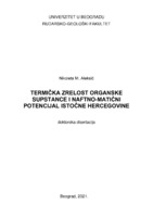
Termička zrelost organske supstance i naftno-matični potencijal istočne Hercegovine
Nikoleta Aleksić (2021)Cilj istraživanja, obrade i interpretacije rezultata prikazanih u disertaciji je utvrđivanje termičke zrelosti organske supstance i naftno-matičnog potencijala sedimentnih stena na području istočne Hercegovine, primenom metoda pirolize Rock-Eval, organo-petrografskog proučavanja organske supstance u normalnoj svetlosti i fluorescenciji, koja je pored kvalitativne analize uključila posebno i refleksiju vitrinita. Osim toga, na osnovu organsko-geohemijskih analiza sagledane su karakteristike i poreklo ekstrahovanog bitumena metodom gasne hromatografije - masene spektrometrije, pri čemu su izvršene analize biomarkera kao geohemijskih indikatora. Tokom rada na doktorskoj ...organska supstanca, termička zrelost, matične stene, naftni potencijal, refleksija vitrinita, piroliza Rock-Eval, biomarkeri, Karbonatna platforma, istočna HercegovinaNikoleta Aleksić. Termička zrelost organske supstance i naftno-matični potencijal istočne Hercegovine, Beograd : [N. Aleksić], 2021
-
The state and perspective of the natural gas sector in Serbia
The strategy of long-term energy development of Serbia identifies an increase of share of natural gas in final energy consumption as one of the main aims. Serbia has signed a strategic agreement with the Russian Federation on cooperation in the oil and gas sector, within which the project South Stream pipeline is planned to be realized. In addition, the Republic of Serbia has signed the Treaty that establishes the Energy Community and accepted the obligation to implement the Energy ...Dejan Ivezić, Marija Živković, Dušan Danilović, Aleksandar Madžarević, Miloš Tanasijević. "The state and perspective of the natural gas sector in Serbia" in Energy Sources, Part B: Economics, Planning and Policy, Taylor & Francis Group, LLC (2016). https://doi.org/http://dx.doi.org/10.1080/15567249.2013.858796
-
Advantages and Disadvantages of a Parallel and Zigzag Method of Acquisition in Walking Mode in Magnetometric Archeological Research
магнетометријска испитивања, цик-цак и паралелна аквизиција у ходајућем моду, линеарне аномалије, археологија... traverses, and to control the data, it is necessary to separate the fi les by using a software tool during the acquisitions. Some companies whose gradiometers are spe- cialised for archaeological research resolve the problem of the zigzag method of acquisition by using the instrument’s software. Before ...
... PROCESSING After the completion of the acquisition, the data was prepared for software processing. In the fi rst three cases, the data which had been acquired outside of the polygons was clipped from the da- tabase, and also the data whose value was outside a range of ± 70 nT/m. The data was arranged ...
... Before the start of the acquisition process, the operator sets the direction and the method of acquisition. The in- strument’s software then prepares the data col- lected in the zigzag method for further computer processing, treating them as if they were collected using a parallel method. Linear anomalies ...Mirko Petković, Vesna Cvetkov, Branislav Sretenović. "Advantages and Disadvantages of a Parallel and Zigzag Method of Acquisition in Walking Mode in Magnetometric Archeological Research" in Arheologija i prirodne nauke (2014)
-
Refinement of waste phosphogypsum from Prahovo, Serbia: characterization and assessment of application in civil engineering
Josip Išek, Lazar Kaluđerović, Nikola Vuković, Maja Milošević, Ivana Vukašinović, Zorica Tomić (2020)... Christidis, Principal Editor of Clay Minerals, and three reviewers for their constructive sug- gestions and corrections, which greatly improved the paper. The authors are also grateful to Dobrila Nikolić, MA in English, for language and style corrections and to the chemical company Elixir Prahovo for ...
... determined from its decay products Th (63keV) and/or "Pa (1000 keV). The ecay products of ? Ra, _ Bi (609, 1120 and 1764keV) and "Pb (295 and 352 keV) were used for activity determination. The activity of 52 Th was calculated using its daughter product ŠAc (338 and 911 keV). K was determined from its single ...
... MPC(Th) MPC(K) Q) where Cgax Crh and Ck are the measured concentrations and MPC (Ra), MPC(Th) and MPC(K) are the maximum permissible con- centrations of “Ra, Th and K, respectively. Equivalent values for building materials used for interior, exterior and civil engineering construction as a ...Josip Išek, Lazar Kaluđerović, Nikola Vuković, Maja Milošević, Ivana Vukašinović, Zorica Tomić. "Refinement of waste phosphogypsum from Prahovo, Serbia: characterization and assessment of application in civil engineering" in Clay Minerals, Cambridge University press (2020). https://doi.org/10.1180/clm.2020.11
-
Groundwater resources for drinking water supply in Serbia´s Southeast Pannonian basin
Dušan Polomčić, Bojan Hajdin, Marina Ćuk, Petar Papić, Zoran Stevanović. "Groundwater resources for drinking water supply in Serbia´s Southeast Pannonian basin" in Carpathian Journal of Earth and Environmental Sciences (2014)
-
Upravljanje proizvodnjom nafte – novi alat na bazi fazi logike
... introducing an artificial lift method. In order to achieve optimal production, the selection of the artificial lift method have an important role. Optimal selection method achieves the economical production. By introducing new tools developed on the basis of artificial intelligence, decision making ...
... new directions, and lessons for the study of modern work. Journal of Organizational Behavior: The International Journal of Industrial, Occupational and Organizational Psychology and Behavior 23(4), 383– 400. [7] Carmel, E. (1999) Global Software Teams: Collaborating Across Borders and Time Zones. Prentice ...
... different places and comes from different sources. It is independent of the programming language and the type of data source. This paper presents the basic characteristics, principles of work, comparison with similar technology as an illustration of the appearance of request and answer. Keywords: ...Мирослав Црногорац, Душан Даниловић, Лола Томић. "Upravljanje proizvodnjom nafte – novi alat na bazi fazi logike" in IX Naučno stručni skup Preduzetništvo, inženjerstvo i menadžment Zrenjanin, 24.10.2020. god., Visoka tehnička škola strukovnih studija u Zrenjaninu (2020)