Претрага
468 items
-
Specific electrical conductivity in epikarst groundwater of the eastern Suva Planina mt.
Branislav Petrović (2022)The epikarst is a part of the karst outcrop that is located within the unsaturated zone and represents a complex point of contact and mixing of unconsolidated material from the terrain surface. The correct and complete perception of epikarst, its degree of development and the presence on the limestone terrain can be achieved with a multidisciplinary approach. The study area for the applied multidisciplinary research was the Eastern part of karst massif Suva Planina Mt. One important part of ...Branislav Petrović. "Specific electrical conductivity in epikarst groundwater of the eastern Suva Planina mt." in KARST 2022: "Importance, State of the Art, and Prospective of Utilization and Protection of Resources in Karst", Serbian Academy of Sciences and Arts (SASA) (2022)
-

Integrating landslide magnitude in the susceptibility assessment of the City of Doboj, using machine learning and heuristic approach
In this work, landslide assessment of the Doboj City area was modeled by combining machine learning and heuristic tools. The machine learning part was used to map the Morphometric factor. i.e. probability of landslides based on relation between the magnitude of events and morphometric parameters: elevation, distance to streams, slope, profile curvature, and aspect. The Random Forest and Support Vector Machines algorithms were implemented in the learning protocol, which included several strategies: balancing of the training/testing set size, algorithm ...Cvjetko Sandić, Miloš Marjanović, Biljana Abolmasov, Radislav Tošić. "Integrating landslide magnitude in the susceptibility assessment of the City of Doboj, using machine learning and heuristic approach" in Journal of Maps, Taylor&Francis (2023). https://doi.org/ 10.1080/17445647.2022.2163199
-
Anthropogenic impact on the groundwater regime: Case study of the Velika Morava alluvium
Jovana Mladenović, Vesna Ristić Vakanjac, Milan Kresojević, Boris Vakanjac, Jugoslav Nikolić, Dušan Polomčić, Dragoljub Bajić (2023)The Velika Morava River originates at the junction of the Južna Morava and Zapadna Morava at the town of Stalać in Serbia. It is 185 km long and empties into the Danube. The Velika Morava River Basin occupies a land area of 37 444 km2. The river flows through central Serbia, which features the most fertile land and the highest population density in the country. Public water supply in this region of Serbia relies on groundwater formed in alluvial ...Jovana Mladenović, Vesna Ristić Vakanjac, Milan Kresojević, Boris Vakanjac, Jugoslav Nikolić, Dušan Polomčić, Dragoljub Bajić. "Anthropogenic impact on the groundwater regime: Case study of the Velika Morava alluvium" in National Conference with International Participation “GEOSCIENCES 2023”, Review of the Bulgarian Geological Society, Sofia : Bulgarian Geological Society (2023)
-

Long-term planning methodology for improving wood biomass utilization
The insufficiently developed forest management system is often followed by undeveloped forest resources supply chain and insufficient institutional support. These cause inefficient usage of fuel-wood as well as huge amounts of unused forest residues. In order to achieve optimal and long-term sustainable utilisation of biomass, an original methodology based on the interaction of mathematical optimization and backcasting approach has been developed. Mathematical optimization is used for both generation and consideration of techno-economic parameters of the forest biomass supply chain. ...Vladimir Vukašinović, Dušan Gordić, Marija Živković, Davor Koncalović, Dubravka Živković. "Long-term planning methodology for improving wood biomass utilization" in Energy, Elsevier BV (2019). https://doi.org/10.1016/j.energy.2019.03.105
-
Serbian Society of Geomorphologists
Dragana Đurić, Jelena Ćalić (2019)Dragana Đurić, Jelena Ćalić. "Serbian Society of Geomorphologists" in GeomorForum 2019: Landforms related to plains of Serbia and its neighboring area, Conference Programme and Abstracts, Beograd, 10-12. maj 2019, Serbian Society of Geomorphologists (2019)
-
Development of integrated fuzzy model for mine management optimization
Miodrag Čelebić, Sanja Bajić, Dragoljub Bajić, Dejan Stevanović, Duško Torbica, Vladimir Malbašić (2023)... bauxite deposit L-29C of the Bešpelj mine near Jajce in the Republic of Serbia, Bosnia and Herzegovina, which is the focus of the paper. Study area and geology. The Bešpelj bauxite mine is located on a spacious karst plateau, on the right bank of the Vrbas River. It is at a beeline distance ...
... particularly investigated in the ore deposit zone, where tectonic transport was most distinct, and found to be rather unfavourable. The most adverse area for underground mining: operations is the zone of contact between the overlying: and underlying, limestones, and especially within the ore deposit ...
... mining: rooms. Figure 1 shows the zone of the ore deposit described in the paper. LEGEND: l — i , 'Syncline and anticline axes: <_ Bebpalj mining area %774 verticall or inclined W |_ 7@,5( Byane d niobe es Fiysch: conglomerates, / / \Unlabeled and non-characterized calcarenites, marlymicrites ...Miodrag Čelebić, Sanja Bajić, Dragoljub Bajić, Dejan Stevanović, Duško Torbica, Vladimir Malbašić. "Development of integrated fuzzy model for mine management optimization" in Comptes rendus de l'Académie Bulgare des Sciences (2023)
-
Determination of the groundwater-leakage mechanism (binary mixing) in a karstic dam site using thermometry and isotope approach (HPP Visegrad, Bosnia, and Herzegovina)
Earth-Surface Processes,Geology, Pollution, Soil Science, Water Science and Technology, Environmental Chemistry, Global and Planetary ChangeLjiljana Vasić, Saša Milanović, Anita Puskás-Preszner, Laszlo Palcsu. "Determination of the groundwater-leakage mechanism (binary mixing) in a karstic dam site using thermometry and isotope approach (HPP Visegrad, Bosnia, and Herzegovina)" in Environmental Earth Sciences, Springer Science and Business Media LLC (2020). https://doi.org/10.1007/s12665-020-08910-x
-
Valorization of non-balanced coal reserves in Serbia for underground coal gasification
David Petrović, Lazar Kričak, Milanka Negovanović, Stefan Milanović, Jovan Marković, Nikola Simić, Ljubisav Stamenić (2019)In the name of a better and safer energy future, it is our responsibility to focus our knowledge and activities to save on imported liquid and gas fossil fuels, as well as coal on which energy security of Serbia is based. The rationalization in the use of available energy resources certainly positively affects economy and the environment of a country. This paper indicates motivations for the application of the underground coal gasification process, as well as surface gasification for ...... pronounced [16, 17]. A special advantage, which is related to the danger of subsidence of the terrain, is hat in the gasified area slag and ash remain in the scattered area. This happens even up to 2/3 of the height of that treated space, which tolerates the possibility of terrain subsidence to be ...
... boreholes that follow the coal layer. Pipes are placed into wells up to the top ofthe coal layer, and the contact of the pipe with the surrounding area is cemented, while borehole is not placed in the tube that is passing through the coal bed. Petrović, D. T., et al.: Valorization of Non-Balanced ...
... in the UCG process effects. Preliminary calculation indicators for possible application of UCG in Serbia Ćirikovac coal deposits and the overall area of the nearby TPP Kostolac is considered to be investigated for the UCG application. For the implementation of UCG process in the pro- 25m 25m 25 ...David Petrović, Lazar Kričak, Milanka Negovanović, Stefan Milanović, Jovan Marković, Nikola Simić, Ljubisav Stamenić. "Valorization of non-balanced coal reserves in Serbia for underground coal gasification" in Thermal Science (2019). https://doi.org/10.2298/TSCI190725390P
-
Mineralogical study of clays from Dobrodo, Serbia, for use in ceramics
Maja Milošević, Predrag Dabić, Sabina Kovač, Lazar Kaluđerović, Mihovil Logar. "Mineralogical study of clays from Dobrodo, Serbia, for use in ceramics" in Clay Minerals, Mineralogical Society (2019). https://doi.org/10.1180/clm.2019.49
-
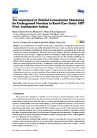
The Importance of Detailed Groundwater Monitoring for Underground Structure in Karst (Case Study: HPP Pirot, Southeastern Serbia)
... operated 4–5 h/day. Surface water reservoir is located at an elevation of 612 m, occupies an area of 5.53 km and has a total volume of 170 × 106 m3. č Figure 1. Geographic position of the study area and schematic representation of the longitudinal section of the tunnel, including elevations. ...
... monitoring adapted to complex hydrogeologic conditions, regarding the operating conditions of the tunnel and potential hydraulically active zones. 2. Study Area The water-conveyance tunnel of HPP Pirot (Southeastern Serbia) is used to transport stored water under pressure to the powerhouse. The tunnel is 9093 ...
... which are represented by a system of east-vergent thrusts. The most significant is the Vidlič thrust, which the tunnel intersects (Figure 2). The study area is mostly built up of carbonate sediments of the Triassic, Jurassic and Cretaceous ages. The Triassic deposits are represented by limestones, dolomites ...Marina Čokorilo Ilić, Ana Mladenović, Marina Ćuk, Igor Jemcov. "The Importance of Detailed Groundwater Monitoring for Underground Structure in Karst (Case Study: HPP Pirot, Southeastern Serbia)" in Water, MDPI AG (2019). https://doi.org/10.3390/w11030603
-
Transboundary groundwater resource management: needs for monitoring the Cijevna River Basin (Montenegro–Albania)
The transboundary Cijevna River Basin shared between Albania and Montenegro has a surface area of 650 km2. It is extremely important for water management, especially in the country of Montenegro which is downstream. Due to the high permeability of both the karst and intergranular aquifers that exist in the basin, the River Cijevna sinks along the length of its riverbed and in summer months it usually dries up completely at the confluence section. Hydrometry surveys undertaken during a drought ...Upravljanje međugraničnim vodama, ranjivost podzemnih voda, monitoring mreža, karstne izdani, Albanija, Crna GoraMomčilo Blagojević, Zoran Stevanović, Milan Radulović, Veljko Marinović, Branislav Petrović. "Transboundary groundwater resource management: needs for monitoring the Cijevna River Basin (Montenegro–Albania)" in Environmental Earth Sciences, Springer Science and Business Media LLC (2020). https://doi.org/10.1007/s12665-020-8809-8
-
Primary crusher site selection in open pit mines - case study in Sungun copper mine
Facility site selection, (such as Primary or in pit Crusher location) is one of the most important steps in mine de-sign process that has a significant impact on economy of the mining operation. This study covers an attempt to find the optimal location forprimary crusher in order to support the expansion of Sungun copper mine, which is the second largest open pit mine in Iran. Recent exploration drilling has led to a considerable increase in the ore reserve. Therefore, ...Ali Nasirinezhad, Dejan Stevanović, Dragan Ignjatović, Mehdi Rahmanpou. "Primary crusher site selection in open pit mines - case study in Sungun copper mine" in Underground mining engineering, Универзитет у Београду, Рударско-геолошки факултет (2021)
-

Rezultati geoloških istraživanja lignita Kostolačko-kovinskog ugljonosnog basena – geološke i morfostrukturne karakteristike
Bogoljub Vučković, Biljana Radovanović, Vesna Matić, Lidija Glamočanin, Bogdan Radić, Ksenija Eraković, Dragana Životić (2022)Geološka istraživanja Kostolačkog basena i ležišta Kovin vrše se više od 80 godina, dok eksploatacija traje više od 100 godina. Tokom dugog perioda rudarskih aktivnosti na površini od oko 320 km2, izbušeno je preko 3.200 bušotina i više od 265.000 m jezgra. Nova saznanja o geološkim karakteristikama, morfologiji i kvalitetu ugljenih slojeva nameću neophodnost reinterpretacije i izrade jedinstvenog 3D modela Kostolačko-kovinskog basena. Primenom savremenih softverskih paketa olakšano je povezivanje ugljenih slojeva sa posebnim osvrtom na morfologiju i kvalitet slojeva i ...Bogoljub Vučković, Biljana Radovanović, Vesna Matić, Lidija Glamočanin, Bogdan Radić, Ksenija Eraković, Dragana Životić. "Rezultati geoloških istraživanja lignita Kostolačko-kovinskog ugljonosnog basena – geološke i morfostrukturne karakteristike" in 18. Kongres geologa Srbije "Geologija rešava probleme", Divčibare, 01-04 jun 2022., Srpsko geološko društvo (2022)
-
Strategic Environmental Assessment and the precautionary principle in the spatial planning of wind farms – European experience in Serbia
Spatial determination planning is at an initial and very sensitive step in the development of wind farms. On one hand, it is important to maximize the potential of wind in a particular area, and on the other hand, it is important to achieve environmental protection (including the human population and natural heritage) in the same space at the same time. With this in mind, it is important to balance all the requirements that are relevant for reaching the optimal ...Boško Josimović, Aleksandar Cvjetić, Danilo Furundžić. "Strategic Environmental Assessment and the precautionary principle in the spatial planning of wind farms – European experience in Serbia" in Renewable and Sustainable Energy Reviews, Elsevier BV (2021). https://doi.org/10.1016/j.rser.2020.110459
-

The Flow Conditions in the Epikarst Zone of a Karst Aquifer. Case Study: Suva planina Mt., East Serbia
Branislav Petrović (2023)The epikarst as a part of the karst aquifer represents a complex point of contact and mixing of unconsolidated material from the terrain surface, carbonate rocks altered by “corrosive” water, flora and fauna (and remains of), which is partially saturated with groundwater. Significant amounts of (plant accessible) water, and other solutes and particles, can be stored in this zone for extended periods of time. Thus, attenuation or biochemical processes could start in this layer and change quality of infiltrated ...Branislav Petrović. "The Flow Conditions in the Epikarst Zone of a Karst Aquifer. Case Study: Suva planina Mt., East Serbia" in International Scientific Conference "Man and Karst 2022", CIRS - Centro Ibleo di Ricerche Speleo-Idrogeologiche (2023)
-
Agates of the Lece Volcanic Complex (Serbia): Mineralogical and Geochemical Characteristics
Agate veins and nodules occur in the Lece Volcanic Complex (Oligocene-Miocene) situated in the south of Serbia and occupying an area of 700 km2. This volcanic complex is composed predominantly of andesites, with sporadic occurrences of andesite-basalts, dacites and latites, and features agate formations that have been very little investigated. This study focuses on five selected agate occurrences within the Lece Volcanic Complex, employing optical microscopy, scanning electron microscopy (SEM), X-ray powder diffraction analysis, inductively coupled plasma mass spectrometry ...Zoran Miladinović, Vladimir Simić, Nenad Nikolić, Nataša Jović Orsini, Milena Rosić. "Agates of the Lece Volcanic Complex (Serbia): Mineralogical and Geochemical Characteristics" in Minerals, MDPI AG (2024). https://doi.org/10.3390/min14050511
-
The Flow Conditions in the Epikarst Zone of a Karst Aquifer. Case Study: Suva planina Mt., East Serbia
Branislav Petrović (2022)The epikarst as a part of the karst aquifer represents a complex point of contact and mixing of unconsolidated material from the terrain surface, carbonate rocks altered by “corrosive” water, flora and fauna (and remains of), which is partially saturated with groundwater. Recharge of karst aquifers, usually, occurs via the unsaturated zone which uppermost part could be epikarst zone. Significant amounts of (plant accessible) water, and other solutes and particles, can be stored in this zone for extended periods ...Branislav Petrović. "The Flow Conditions in the Epikarst Zone of a Karst Aquifer. Case Study: Suva planina Mt., East Serbia" in International Scientific Conference - Man and Karst 2022, Custonaci, Italy, 12-16.09.2022, Gruppo Grotte Ragusa - C.I.R.S. (2022)
-
Filling of dolines with aeolian sediments in the high-mountain karst of the Dinarides (Mt. Durmitor, Montenegro)
Filling of dolines with aeolian sediments, one of the less frequently described ways in which they are filled, is analysed in the present study on an example of a doline in the high-mountain karst of the Dinarides. There is a series of deep dolines on a broad ridge (about 2450 m a.s.l.) on Mt. Durmitor (Montenegro) in the southeastern part of the Dinarides. The accumulation of very fine-grained sand that almost completely fills one of the dolines was analysed. ...Mirela Djurović, Violeta Gajić, Predrag Djurović. "Filling of dolines with aeolian sediments in the high-mountain karst of the Dinarides (Mt. Durmitor, Montenegro)" in Journal of mountain science, Science Press (2022). https://doi.org/10.1007/s11629-021-7274-5
-
Assessment of spa mineral water quality from Vrnjačka Banja, Serbia: geochemical, bacteriological, and health risk aspects
Nebojša Đ. Pantelić, Simona Jaćimović, Jana Štrbački, Danijela B. Milovanović, Biljana P. Dojčinović, Aleksandar Ž. Kostić (2019)The goal of this study is to evaluate the quality of seven natural mineral water sources in the Vrnjačka Banja area used in the treatment of various diseases. The 24 macro- and microelements were determined by inductively coupled plasma optical emission spectrometry (ICP-OES). The results show that element content was within allowed limits of concentration, except for B, As, and Se. The evaluated content of these elements can be associated with geological and anthropogenic factors. The sample S6 contains ...Nebojša Đ. Pantelić, Simona Jaćimović, Jana Štrbački, Danijela B. Milovanović, Biljana P. Dojčinović, Aleksandar Ž. Kostić. "Assessment of spa mineral water quality from Vrnjačka Banja, Serbia: geochemical, bacteriological, and health risk aspects" in Environmental Monitoring and Assessment, Springer Science and Business Media LLC (2019). https://doi.org/10.1007/s10661-019-7848-7
-
Natural two-dimensional pyrophyllite: Nanoscale lubricant, electrical insulator and easily-machinable material
Borislav Vasić, Radoš Gajić, Ivana Milošević, Žarko Medić, Marina Blagojev, Marko Opačić, Aleksandar Kremenović, Dejan Lazić (2022)Pyrophyllite, with the chemical formula Al2Si4O10(OH)2, is a naturally occurring and abundant van der Waals mineral belonging to the group of phyllosilicates. It is very soft, layered crystal used for sculpting and an excellent electrical and thermal insulator aimed for the operation at high pressure and temperature. Here, for the first time, two-dimensional (2D) pyrophyllite obtained by both mechanical and liquid phase exfoliation is presented and investigated at the nanoscale. The layered structure provides low friction coefficient of around ...Atomic force microscopy, Insulating properties, Nanofriction and wear, Natural two dimensional materials, Phyllosilicates, PyrophylliteBorislav Vasić, Radoš Gajić, Ivana Milošević, Žarko Medić, Marina Blagojev, Marko Opačić, Aleksandar Kremenović, Dejan Lazić. "Natural two-dimensional pyrophyllite: Nanoscale lubricant, electrical insulator and easily-machinable material" in Applied Surface Science, Elsevier BV (2022). https://doi.org/10.1016/j.apsusc.2022.155114