Претрага
408 items
-
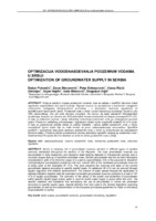
Optimizacija vodosnabdevanja podzemnim vodama u Srbiji
Dušan Polomčić, Zoran Stevanović, Petar Dokmanović, Vesna Ristić-Vakanjac, Bojan Hajdin, Saša Milanović, Dragoljub Bajić (2012)... Neogene Karstna Pukotinska Ukuono jedinica jan kompleks naslage sredina sredina P nanos! (Vojvodina) Backa i Banat 1,45 3,57 0,43 - - 5,45 Srem, Maéva, Sava / 6,97 0,34 0,50 0,03 - 7,84 Tamnava Centrala Srbija 2,58 - 0,84 0,43 - 3,85 Istoéna Serbija 0,62 - 0,06 1,71 - 2,39 Sie 0,24 . 0,14 1,61 - 1,99 Zapadna ...
... Pukotinska Hidrogeoloska jedinica ; F . Ukupno nanosi kompleks naslage sredina sredina (Vojvodina) Backa i Banat 9,39 4,91 0,55 0 0 14,85 Srem, Macva, Sava / 21,11 0,55 0,99 0,10 0 22,75 Tamnava Centrala Srbija 9,93 0 1,73 1,48 0,18 13,32 Istoéna Srbija 1,06 0 0,24 2,98 0 4,28 Jugozapadna Srbija 0,57 0 ...
... i kategorizaciji rezervi podzemnih voda (1978), Pravilnik o higijenskoj ispravnosti vode za pice (1998), Pravilnik o naéinu odredivanja i odrzavanja zona i pojaseva sanitarne za&Stite objekata za snabdevanje vodom za pice (2008), kao i Pravilnik o kvalitetu i drugim zahtevima za prirodnu mineralnu vodu ...Dušan Polomčić, Zoran Stevanović, Petar Dokmanović, Vesna Ristić-Vakanjac, Bojan Hajdin, Saša Milanović, Dragoljub Bajić. "Optimizacija vodosnabdevanja podzemnim vodama u Srbiji" in Zbornik radova XIV srpskog simpozijuma o hidrogeologiji sa međunarodnim učešćem, Zlatibor, 17-20. maj 2012. godine , Beograd : Rudarsko-geološki fakultet (2012)
-
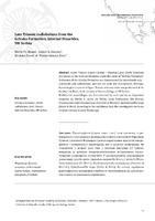
Late Triassic radiolarians from the Grivska formation, internal Dinarides, SW Serbia
Paleontology, Stratigraphy, Economic Geology, Geochemistry and Petrology, Geology, Geophysics, Geotechnical Engineering and Engineering Geology... Geol. an. Balk. poluos., 2019, 80 (1), 17–27 Late Triassic radiolarians from the Grivska Formation, Internal Dinarides, SW Serbia Sava suture West Vardar Drina-Ivanjica Unit -——— Late Jurassic obduction Sediments of ths passive margin of Adria (Jurassc) Sediments of th» passive margin ...
... Capnodoce sp. correlates with the lower part of Zone Capnodoce of North Capnuchosphaera sp. cf. C. tricornis DE WEVER Sarla hadrecaena (DE WEVER) Sarla ? sp. America (BLoME, 1984), Zone TR6A of Japan (SUGIYAMA, EIlisus ? sp. 1997), Zone Capnodoce ruesti EIlisus sp. cf. E. siscwaiensis ...
... Simplified geologic map ofthe wider investigation area {modified after DJERIĆ et al. 2012). Geol. an. Balk. poluos., 2019, 80 (1), 17–27 East Vardar Jadar East-Bosnian-Durmitor Unit - Ophiolitic melange ——— Late Jurassic obduction Sediments of the passive margin of Adria (Jurassic) ...Nikita Bragin, Liubov Bragina, Nevenka Đerić, Nataša Gerzina-Spajić. "Late Triassic radiolarians from the Grivska formation, internal Dinarides, SW Serbia" in Geološki anali Balkanskoga poluostrva (2019). https://doi.org/10.2298/GABP1901017B
-

Control of substructure construction of railways in the Republic of Serbia
Контрола збијености природног тла (у ископу) или збијеног у насипу при изградњи саобраћајница представља један од основних облика контроле квалитета доњег строја. Код изградње брзих саобраћајница (аутопутеви и брза железница) приоритет је постизање високог нивоа контроле извршених радова. У циљу онемогућавања диференцијалног слегања (при изградњи насипа), или промене запремине услед допунског збијања материјала, које неминовно доводе до деформација, потребно је извршити оптимално збијање материјала. У оквиру овог рада приказује се техничка регулатива која регулише контролу збијености при изградњи железничке ...... Frost action zone I (m) II (m) III (m) Open track tracks, running (through) track and relief tracks 120 1,00 80 1,00 0,50 0,60 0,70 other tracks 80 0,97 45 0,95 0,30 0,40 0,50 Note: Until the detailed zoning of Serbia on frost for all railways within the Corridor X project, adopt zone III of the ...
... determine profiles for testing according to the standard and technical conditions (harmonized with the standard) determine in examination process the zone where soil homogeneity is ensured (by granulometric composition and moisture) and in statistically reliable research conditions. Perform the necessary ...
... ON CONTEMPORARY THEORY AND PRACTICE IN CONSTRUCTION XV light falling weight (determination of the dynamic modulus of deformation Evd) in that zone, and with constant monitoring of moisture. enter the results of the on-site test in Table 4, which is signed by the responsible contractor, the r ...Dragan Lukić, Dragoslav Rakić, Irena Basarić Ikodinović. "Control of substructure construction of railways in the Republic of Serbia" in International Conference On Contemporary Theory and Practice in Construction XV, Banja Luka 16-17 jun 2022., University of Banja Luka Faculty of Architecture, Civil Engineering and Geodesy (2022)
-

Analiza primenjenih metoda za transport parafinske nafte
Dunja Milojević (2024)Sadržaj parafina u nafti ima dominantan uticaj na svojstva parafinskih nafti. Taloženje parafina, odnosno taloženje čvrstih čestica parafinskog voska, predstavlja ozbiljan globalni problem tokom proizvodnje i transporta sirove nafte. Samo taloženje voska zavisi od termodinamičkih faktora, poput temperature, pritiska i sastava nafte. Transport nafte cevovodima je uobičajeni proces transporta u naftnoj industriji. Kada prilikom cevovodnog transporta parafinske sirove nafte, dođe do prekida protoka i hlađenja nafte ispod temperature stinjavanja, parafini će kristalisati, pri čemu će doći do, geliranja celokupne transportovane ...... niže od zone taloženja parafina radi boljeg efekta mešanja sa naftom i početka delovanja pri višim temperaturama. Zbog toga kod hemijskih metoda nije potrebno precizno odrediti zonu taloženja parafina. Međutim, kod primene mehaničkih i termičkih metoda neophodno je precizno definisati zonu taloženja ...
... Aditivi se utiskuju najčešće na dnu bušotine ili znatno niže od zone taloženja parafina radi boljeg efekta mešanja sa naftnom i početka delovanja pri višim temperaturama. Zbog toga kod hemijskih metoda nije potrebno precizno odrediti zonu taloženja parafina. Samim tim predstavlja uspešnu metodu, ali ...
... parafinske nafte, danas se primenjuju različite metode: mehaničke, termičke, hemijske (i mikrobne). Njihova primena zahteva precizno definisanje zone taloženja parafina. (Danilović & sar., Laboratorijsko ispitivanje i simulacija procesa taloženja parafina u naftnoj bušotini polja Turija u Vojvodini ...Dunja Milojević. Analiza primenjenih metoda za transport parafinske nafte, 2024
-
Simple 2D gravity–density inversion for the modeling of the basin basement: example from the Banat area, Serbia
We have developed a technique to calculate lateral density distribution of the sedimentary basin basement by combining linear gravity–density inversion and 2D forward modeling. The procedure requires gravity anomaly data, depth-to-basement data and density data for the sediments (density–depth distribution). Gravity efect of density variations in the basement was extracted from the total gravity anomaly by removing the joint efect of the sediments with vertical density variations and homogeneous basement of average density contrast (calculated by 2D modeling). Gravity ...Ivana Vasiljević, Snežana Ignjatović, Dragana Đurić. "Simple 2D gravity–density inversion for the modeling of the basin basement: example from the Banat area, Serbia" in Acta Geophysica, Springer (2019). https://doi.org/10.1007/s11600-019-00328-9
-

Геохемијске карактеристике флотацијског јаловишта рудника Грот (југоисточна Србија)
Božidar Đokić (2012-07-16)У дисертацији су анализиране геохемијске карактеристике флотацијскогјаловишта које се налази на највишој надморској висини у Србији. Јаловиште јенастало преграђивањем узводно од Селишког потока. Географске, геолошке игеоморфолошке карактеристике области у којима је смештено највећим делом суутицали на његову морфологију и морфометрију. Јаловиште чини велики, јужни ијугоисточни плато и велика брана. Делови јаловишта су засебно испитивани, азатим и њихова међусобна интеракција и утицаји на окружење.Прикупљени узорци су испитивани рендгенском дифракциономанализом, скенирајућом електронском микроскопијом, рендгенскомфлуоресцентном спектрометријом, гранулометријском и хемијском анализом.Рендгенском дифракционом анализом ...флотација, јаловиште, скенирајућа електронско-микроскопскаанализа, рендгенска флуоресцентна спектрометрија, Pb-Zn руда,тешки метали, контаминација... структура у комбинацији са Зоне Субзоне 1 Спољна зона Ia Хлорит-необиотитска Ib Необиотитска 2 Средња зона IIa Необиотит-кордијеритска IIb Необиотит-кордијерит-андалузитска IIc Необиотит (±) кордијерит-андалузит (±фибролит)-неоК- фелдспатска 3 Унутрашња зона IIIa Необиотит-корди ...
... типова. На основу асоцијације минерала у контактно-метаморфном ореолу сурдуличког гранитоида издвојене су четири зоне и осам субзона (табела 3, Васковић, 1997). Табела 3. Минералне зоне и субзоне контактно–метаморфног ореола сурдуличког гранитоида (Васковић, 1997) Зелени шкриљци власинског комплекса ...
... синклинале појављују се разломне зоне лонгитудиналног до дијагоналног положаја које прате катаклазирани шкриљци. Југозападно крило показује тенденције повијања ка истоку уз ширење синклинале према северу. Његова периферија је веома разломљена лонгитудиналним зонама од којих се најмаркантнија пружа ...Božidar Đokić. "Геохемијске карактеристике флотацијског јаловишта рудника Грот (југоисточна Србија)" in Универзитет у Београду, Универзитет у Београду, Рударско-геолошки факултет (2012-07-16)
-
Numerical simulation of the Late Jurassic closure of the Vardar Tethys
... occurrence of three major, presently observed geologicalentities that are left behind after the closure of the Vardar Tethys. These include: ophiolite-likeigneous rocks of the Sava-Vardar zone and presumably subduction related Timok MagmaticComplex, both Late Cretaceous in age as well as Jurassic ophiolites ...
... simulation of the Late Jurassic closure of the Vardar Tethys Nikola Stanković, Vesna Cvetkov, Vladica Cvetković Дигитални репозиторијум Рударско-геолошког факултета Универзитета у Београду [ДР РГФ] Numerical simulation of the Late Jurassic closure of the Vardar Tethys | Nikola Stanković, Vesna Cvetkov ...
... (nikola.stankovic@rgf.rs) We report updated results of our ongoing research on constraining geodynamic conditionsassociated with the final closure of the Vardar branch of the Tethys Ocean by means of applicationof numerical simulations (previous interim results reported in EGU2020-5919). The aim of our numerical ...Nikola Stanković, Vesna Cvetkov, Vladica Cvetković. "Numerical simulation of the Late Jurassic closure of the Vardar Tethys" in EGU General Assembly 2021, Copernicus GmbH (2021). https://doi.org/10.5194/egusphere-egu21-9893
-

2D Numerical Simulation of Intraoceanic Subduction during the Upper Jurassic Closure of the Vardar Tethys
... occurrence of three major, presently observed geologicalentities that are left behind after the closure of the Vardar Tethys. These include: ophiolite-likeigneous rocks of the Sava-Vardar zone and presumably subduction related Timok MagmaticComplex, both Late Cretaceous in age as well as Jurassic ophiolites ...
... Jurassic Closure of the Vardar Tethys Nikola Stanković, Vesna Cvetkov, Vladica Cvetković Дигитални репозиторијум Рударско-геолошког факултета Универзитета у Београду [ДР РГФ] 2D Numerical Simulation of Intraoceanic Subduction during the Upper Jurassic Closure of the Vardar Tethys | Nikola Stanković ...
... (nikola.stankovic@rgf.rs) We report updated results of our ongoing research on constraining geodynamic conditionsassociated with the final closure of the Vardar branch of the Tethys Ocean by means of applicationof numerical simulations (previous interim results reported in EGU2020-5919). The aim of our numerical ...Nikola Stanković, Vesna Cvetkov, Vladica Cvetković. "2D Numerical Simulation of Intraoceanic Subduction during the Upper Jurassic Closure of the Vardar Tethys" in EGU General Assembly 2020, Copernicus GmbH (2020). https://doi.org/10.5194/egusphere-egu2020-5919
-
Optimization and Analysis of Drilling and Blasting Parameters Using O-Pitblast Software
The development of modern technologies has enabled the application of specialized softwares in the field of mining through various segments and processes, including in works related to drilling and blasting. The application of specialized software for drilling and blasting with the use of modern technologies such as photogrammetry enabled more accurate data from the field for later processing. By processing data and creating a 3D model of the terrain for drilling and blasting works, it can obtain precise data, ...Stefan Milanović, Nikola Simić, Lazar Kričak, Milanka Negovanović, Nikola Đokić. "Optimization and Analysis of Drilling and Blasting Parameters Using O-Pitblast Software" in Podzemni radovi, Beograd : Rudarsko-geološki fakultet (2024)
-
Development of integrated fuzzy model for mine management optimization
Miodrag Čelebić, Sanja Bajić, Dragoljub Bajić, Dejan Stevanović, Duško Torbica, Vladimir Malbašić (2023)... Geomechanical properties were particularly investigated in the ore deposit zone, where tectonic transport was most distinct, and found to be rather unfavourable. The most adverse area for underground mining: operations is the zone of contact between the overlying: and underlying, limestones, and especially ...
... and its immediate environment. Experience indicates a danger of limestone blocks detaching from the ceilings of mining: rooms. Figure 1 shows the zone of the ore deposit described in the paper. LEGEND: l — i , 'Syncline and anticline axes: <_ Bebpalj mining area %774 verticall or inclined W ...Miodrag Čelebić, Sanja Bajić, Dragoljub Bajić, Dejan Stevanović, Duško Torbica, Vladimir Malbašić. "Development of integrated fuzzy model for mine management optimization" in Comptes rendus de l'Académie Bulgare des Sciences (2023)
-

The Rift Sequence Stratigraphy of the Itebej Field (Pannonian Basin, Serbia)
... wells. Pre-rift stage is represented by deep-water Late Cretaceous turbidites and Late Jurassic ophiolites (ophiolitic mélange) of the Eastern Vardar Zone. The boundary between the syn-rift depositional sequence and pre-rift stage is marked by unconformity at the bottom of Miocene sediments. The rift ...Saša Ivanišević, Jelena Radišić, Ivana Isić, Dejan Radivojević. "The Rift Sequence Stratigraphy of the Itebej Field (Pannonian Basin, Serbia)" in AAPG Vienna, Paratethys petroleum systems between Central Europe and the Caspian Region, Vienna, 26-27 mart, 2019, AAPG (2019)
-
Strategic Environmental Assessment in the Application of Preventive Protection for Wind Farm Noise—Case Study: Maestrale Ring Wind Farm
Determining the spatial position of wind turbines is the initial and most important phase in the development of a wind farm project. In this sensitive phase, all potential problems that may arise in the later stages of project development should be prevented by means of spatial and urban planning instruments. This makes it possible to achieve maximum use of the potential of wind in a particular space and, thus, fulfil the technical and economic requirements of the project while ...Energija,energetski inženjering i elektroenergetska tehnologija,obnovljivi izvori energije, održivost i životna sredina,električni i elektronski inženjering,kontrola i optimizacija,inženjering... center, business, administrative zone with apartments, zones along highways and roads 65 55 6 Industrial, storage and service areas and transport terminals without residential buildings At the border of this zone, the noise must not exceed the limit value in the zone with which it borders Energies ...
... Objective Indicators Social factors 12. Reduce the population’s exposure to an in- creased level of noise − Number of residential buildings in the zone with increased noise levels − The total noise indicator according to the methodology for cal- culating it in the rules for the national list of ...
... Table 4. Excerpt from the table “SEA objectives and indicators” related to noise. (Source: SEA for the Urban Plan of the Maestrale Ring wind farm). Zone Purpose of the Space Noise Level, LAeq (dB) Day and Evening (Guidelines for Community Noise, World Health Organization (WHO), 1999)) Night ...Boško D. Josimović, Aleksandar Cvjetić, Božidar Manić. "Strategic Environmental Assessment in the Application of Preventive Protection for Wind Farm Noise—Case Study: Maestrale Ring Wind Farm" in Energies, MDPI AG (2021). https://doi.org/10.3390/en14196174
-
Природни потенцијал минералних вода Србије - Natural potential of mineral waters in Serbia
Оливера Крунић (2021)Оливера Крунић. "Природни потенцијал минералних вода Србије - Natural potential of mineral waters in Serbia" in Рационално коришћење земљишта и вода у Србији - Sustainable Use of Land and Water in Serbia- Serbian Academy of Sciences and Arts; Scientific Conferences Volume CXCVII; Department of Chemical and Biological Sciences, Book 19, Српска академија наука и уметности (2021)
-
New insights into tectonic relations between the Eastern Vardar Ophiolitic and Serbo-Macedonian units: Inferences from a microtectonic study in central Serbia
Maja Maleš, Nikola Ranđelović, Nemanja Krstekanić, Bojan Kostić, Nikolina Ćirić, Uroš Stojadinović (2023)Источно-вардарски офиолити, Српско-македонска јединица, микротектонска анализа, каснојурска обдукција, пост-обдукционе деформацијеMaja Maleš, Nikola Ranđelović, Nemanja Krstekanić, Bojan Kostić, Nikolina Ćirić, Uroš Stojadinović. "New insights into tectonic relations between the Eastern Vardar Ophiolitic and Serbo-Macedonian units: Inferences from a microtectonic study in central Serbia" in Geološki anali Balkanskoga poluostrva (2023). https://doi.org/10.2298/GABP230130002M
-
Depth estimation of archeological objects using Euler 3D deconvolution of magnetic data
Vesna Cvetkov, Ilija Vasiljević, Mirko Petković. "Depth estimation of archeological objects using Euler 3D deconvolution of magnetic data" in 5. Hrvatski geološki kongres. Abstract Book 5th Croatian Geological Congress, Hrvatski geološki institut (2015)
-
2D geoelectrical resistivity tomography application at the former city waste dump "Ada Huja": Eco-geological problem
... rectangle shows a very low resistivity value zone (1.2 Ωm). Comparing it to the geotechnical profile the waste is laying on top of the marl basis which starts to be detected at the depth of around 8-8.5 m. Using the 2D geoelectrical scanning method, that zone was not detected even though marl has an ...
... profile line can have different resistivity scales. Part three of the profile line I has a length of 124 m (Figure 4). A high value resistivity zone with a length of 56 m (252 m to 308 m of the profile line) can be noticed and it represents most likely sand, gravel and other construction materials ...
... SITE “ADA HUJA” 3.1 Basic Information Convenient location of the former waste site “Ada Huja” (4 km from the Belgrade city center, first city zone) resulted in the housing development for 900 to 2000 people built on the most unsanitary locality in Belgrade (housing development “Deponija”). In ...Branislav Sretenović, Filip Arnaut, Ivana Vasiljević, Vesna Cvetkov. "2D geoelectrical resistivity tomography application at the former city waste dump "Ada Huja": Eco-geological problem" in Podzemni radovi, Centre for Evaluation in Education and Science (CEON/CEES) (2019). https://doi.org/10.5937/PodRad1934059S
-

Mineral Resources of Serbia: Environmental, Societal and Economic Challenges
... 2. Budva-Cukali Zone, 3. High Karst Unit, 4. Pre-Karst and Bosnian Flysch Unit, 5. East Bosnian-Durmitor Thrust Sheet, 6. Dinaric Ophiolitic Belt, 7. Western Vardar Ophioliic Unit, 8. Drina-Ivanjica Thrust Sheet, 9. Jadar-Kopaonik Thrust Sheet, 10. Sava Zone, 11. Eastern Vardar Ophiolitic Unit ...
... ved units (Zelic et al. 2010). The Europe-derived continental units include metamorphic and sedimentary rocks of the Sava zone (Ustaszewski et al. 2010). The whole Vardar zone is characterised by widespread intrusive and effusive Oligocene to Pliocene magmatic rocks of calc-alkaline affinity ...
... along the fault zone in the Vardar zone (the Podrinje ore district, the Golija ore district, the Rogozna ore district, the Šumadija zone, the Kopaonik Zone and the Lece-Halkidiki zone) and, partly, Serbo-Macedonian Massif (the Besna Kobila – Osogovo zone), the Bor metallogenic zone etc. The importance ...Vladimir Simić, Rade Jelenković, Dragana Životić. "Mineral Resources of Serbia: Environmental, Societal and Economic Challenges" in Serbia: Current Issues and Challenges in the Areas of Natural Resources, Agriculture and Environment,, Nova Science Publishers, Inc. (2019)
-
Određivanje parametara smičuće čvrstoće tla primenom statističke metode
Božidar Rudnjanin (2024)Određivanje parametara smičuće čvrstoće tla je od ključne važnosti u geotehničkom inženjerstvu jer utiče na stabilnost i nosivost raznih građevinskih konstrukcija. Ovaj master rad obrađuje temu primene deskriptivne statistike za analizu parametara smičuće čvrstoće tla,čime se obezbeđuje osnov za donošenje odluka o planiranju i izvođenju građevinskih projekata.U prvom delu rada, prikupljaju se relevantni podaci o smičućoj čvrstoći tla iz prethodnih laboratorijskih ispitivanja za trasu buduće brze saobraćajnice Novi Sad - Ruma.Ti podaci uključuju vrednosti smičuće čvrstoće i različite faktore ...... pukotinske i rasedne zone. U zoni većih jaruga formirane su i plavinske lepeze. Česte su i pojave nestabilnosti, u vidu manjih klizišta koja su formirana uglavnom ispod postojećeg puta, ređe na kosinama iznad puta. Teren u zoni ulaznog portala je strm, nagiba 15-30%, lokalno u zoni jaruga ı vododerina ...
... 468m.n.v., prolazi Iriški Venac i izlazi sa druge strane prevoja, na kraju nacionalnog parka. Teren na ovom delu Je blažeg nagiba, oko 5–15", a u zoni izlaznog portala se oštrije spušta ka Iriškom potoku pod nagibom oko 30". Ulazni portal tunela nalazi se na koti 231m.n.v., dok su kote na izlaznom ...
... n.v. Ravničarsko-brežuljkasti deo terena obuhvata severne delove Fruške gore, sve do Rume. Teren posle tunela Je blažeg nagiba 5–20", lokalno u zoni potoka, Jaruga i vododerina i do 40%. Česte su nestabilnosti, u nožičnim delovima padine, sada u vidu srednjih i većih klizišta. Ova klizišta imaju ...Božidar Rudnjanin. Određivanje parametara smičuće čvrstoće tla primenom statističke metode, 2024
-
Investigating distant effects of the Moesian promontory: Brittle tectonics along the western boundary of the Getic unit (East Serbia)
In this study, we report evidence for brittle deformation in a part of the Carpatho–Balkan orogen, which is explained in terms of effects of the rigid Moesian promontory of the European plate on fault kinematics in East Serbia. We focus on the westernmost part of the Getic Unit of the East Serbian Carpatho–Balkanides, i.e. the Gornjak–Ravanica Unit, located between two main thrusts that were repeatedly activated from Early Cretaceous to recent times. We combine a new data set on ...Getikum, Mezijska jedinica, Karpato-balkanski orogen, krte deformacije, Gornjačko-ravanička jedinicaAna Mladenović, Milorad D. Antić, Branislav Trivić, Vladica Cvetković. "Investigating distant effects of the Moesian promontory: Brittle tectonics along the western boundary of the Getic unit (East Serbia)" in Swiss Journal of Geosciences, Springer (2019). https://doi.org/10.1007/s00015-018-0324-5