Претрага
259 items
-
Развој геолошког информационог система Републике Србије
Геолошки информациони систем Србије (ГеолИСС) је пројектован, првенствено, са намером ефикасног дигиталног архивирања геолошких и њима сродних података. У овом раду је приказана структура базе података као основа за развој геолошки конципираног ГИС-а. Нови, објектно орјентисани (О-О) начин моделирања омогућио је дефинисање самосталних типова објеката, хијерархијски повезаних кроз тополошке и друге релације, чиме је обезбеђена њихова медјусобна интеракција. Објектно оријентисано моделирање извршено је коришћењем унифицираног језика моделирања (UML) и CASE алата, кроз концептуални и логички ниво. Физички модел ће ...... Јованова 32 б, Београд, bsblagojevic@yahoo.com 2 Рударско-геолошки факултет, Ђушина 7, Београд, btrivic@rgf.bg.ac.yu 3 Рударско-геолошки факултет, Каменичка 6, Београд, banjac@afrodita.rcub.bg.ac.yu 4 Рударско-геолошки факултет, Ђушина 7, Београд, ranka@rgf.bg.ac.yu 5 Министарство науке и заштите животне ...
... Претрага репозиторијума доступна је на www.dr.rgf.bg.ac.rs The Digital repository of The University of Belgrade Faculty of Mining and Geology archives faculty publications available in open access, as well as the employees' publications. - The Repository is available at: www.dr.rgf.bg.ac.rs 14. Конгрес ...
... 5. UML scheme of the geological age classes 14. Конгрес Геолога Србије и Црне Горе / 14th Congress of Geologists of Serbia and Montenegro cd GeoloskeRelacije RelacijeKoncepta RelacijeOpserv acija Сл. 6. UML схема класа геолошких релација. Fig. 6. UML scheme of the geological relation ...Бранислав Благојевић, Бранислав Тривић, Ненад Бањац, Ранка Станковић, Велизар Николић. "Развој геолошког информационог система Републике Србије" in 14. конгрес геолога Србије и Црне Горе са међународним учешћем, Нови Сад, 18-20. октобар 2005, Cpпско геолошко друштво и Caвeз геолошких друштава Србије и Црне Горе (2005)
-
Classification of Terms on a Positive-Negative Feelings Polarity Scale Based on Emoticons
Mihailo Škorić (2017)The goal of this paper is to draw attention to the possibility of using emoticon-riddled text on the web in language-neutral sentiment analysis. It introduces several innovations in the existing framework of research and tests their effectiveness. It also presents a software tool especially made for that purpose, explains how it builds a database with sentimental value of terms and offers the user manual. Finally, it presents a software tool that tests the new database and gives some examples ...... intonation in the written text. The intensity values of a determiner directly affects the intensity value which he transfer onto the term. Also, the closer the determiner is to the term, the more its value affects the value of the term. 70 Infotheca Vol. 17, No. 1, 2017 Scientific paper For the database ...
... need to confirm the process in an additional dialog box that will appear on the screen. Once the user is satisfied with the settings he can switch to the sec- ond part of the extraction, which is done by pressing ekstraktuj vrednosti iz teksta (extract values from the text) button on the production tab ...
... affect the segment value, while the message of person B has no effect on it, because the determiner in that message refers to the text in the same message 2. if the message contains text, but not a determiner, and the following message contains determiner but not text – determiner will refer to the previous ...Mihailo Škorić. "Classification of Terms on a Positive-Negative Feelings Polarity Scale Based on Emoticons" in Infotheca, Faculty of Philology, University of Belgrade (2017). https://doi.org/10.18485/infotheca.2017.17.1.4
-

Multihazard Exposure Assessment on the Valjevo City Road Network
Miloš Marjanović, Biljana Abolmasov, Svetozar Milenković, Uroš Đurić, Jelka Krušić, Mileva Samardžić Petrović (2019)Miloš Marjanović, Biljana Abolmasov, Svetozar Milenković, Uroš Đurić, Jelka Krušić, Mileva Samardžić Petrović. "Multihazard Exposure Assessment on the Valjevo City Road Network" in Spatial Modeling in GIS and R for Earth and Environmental Sciences, Elsevier Inc (2019). https://doi.org/10.1016/B978-0-12-815226-3.00031-4.
-
Review: Methodological approaches and research techniques for addressing construction and remediation problems in karst reservoirs
Saša Milanović, Ljiljana Vasić (2021)Saša Milanović, Ljiljana Vasić. "Review: Methodological approaches and research techniques for addressing construction and remediation problems in karst reservoirs" in Hydrogeology Journal, Springer Science and Business Media LLC (2021). https://doi.org/10.1007/s10040-020-02280-1
-
Mathematical modeling to define catchment size and real evapotranspiration (case study: Andrića karst spring, Western Serbia)
Marina Čokorilo Ilić, Vesna Ristić Vakanjac, Dušan Polomčić, Dragoljub Bajić, Jelena Ratković, Bojan Hajdin (2018)Water resources in karst are extremely important sources of drinking water supply. The quality of groundwater formed in karst aquifers is generally high and in most cases only chlorination is required. However, from a hydrogeological perspective, these water resources are the least studied. Often only basic information is available on catchment size, groundwater reserves (dynamic and static, if any) and groundwater balance. Detailed hydrogeological investigations and long-term monitoring of karst spring discharges are needed to acquire such information. In ...Marina Čokorilo Ilić, Vesna Ristić Vakanjac, Dušan Polomčić, Dragoljub Bajić, Jelena Ratković, Bojan Hajdin. "Mathematical modeling to define catchment size and real evapotranspiration (case study: Andrića karst spring, Western Serbia)" in National Conference with international participation “Geosciences 2018”, Bulgarian Geological Sciety (2018)
-
A contribution to the understanding of the discharge dynamics and water balance of the karst spring Gornji Dušnik (Suva Planina)
A sufficiently long time-series of daily discharges is needed to assess the discharge dynamics and calculate the water balance equation parameters of a spring (river source). The paper assumes that a catchment is gauged if a time-series of observations of at least 30 years is available, which is a rare case in Serbia. One-year monitoring is often set up to verify the reserves of a water source or spring intended for capture. Monitoring ceases after the final report is ...Aleksandar Tanasković, Vesna Ristić Vakanjac, Dušan Polomčić, Jelena Ratković. "A contribution to the understanding of the discharge dynamics and water balance of the karst spring Gornji Dušnik (Suva Planina)" in National Conference with International Participation “GEOSCIENCES 2023”, Review of the Bulgarian Geological Society, Sofia : Bulgarian Geological Society (2023)
-
Spatial assessment of the areas sensitive to degradation in the rural area of the municipality Čukarica
Nature and Landscape Conservation, Soil Science, Agronomy and Crop Science, Water Science and TechnologyNatalija Momirović, Ratko Kadović, Veljko Perović, Miloš Marjanović, Aleksandar Baumgertel. "Spatial assessment of the areas sensitive to degradation in the rural area of the municipality Čukarica" in International Soil and Water Conservation Research, Elsevier BV (2019). https://doi.org/10.1016/j.iswcr.2018.12.004
-
A hydrogeological model of the open-cast mine Tamnava - West Field (Kolubara Coal Basin, Serbia)
... model of the open-cast mine… 45 2. STUDY AREA KBC occupies a land area of about 600 km2. It is located some 50 km southwest of the capital Belgrade (Fig. 1) and encompasses the area around the middle and lower courses of the Kolubara River and its tributaries: the Tamnava (left) and the Peštan ...
... alluvial and terrace riverine-lacustrine sediments made up of medium- grain gravels and sandy gravels (river terraces and alluvial plains - riverbed sediments of the Kolubara, the Kladnica, the Turija and the Peštan). There are also other deposits, such as diluvial/proluvial and oxbow sediments - silty clays ...
... lower river terrace; Q, Pl - riverine-lacustrine terrace; Pl1 - sand and clay (marly and coaly) There is a triple aquifer system in the extended zone of the study area: upper, intermediate and lower. The three aquifers are all confined and feature a subartesian groundwater level. The upper ...Jelena Ratković, Dušan Polomčić, Dragoljub Bajić, Bojan Hajdin. "A hydrogeological model of the open-cast mine Tamnava - West Field (Kolubara Coal Basin, Serbia)" in Underground Mining Engineering no. 29, Belgrade : University of Belgrade - Faculty of mining and geology (2016): 43-54
-
Environmental flows and demands for sustainable water use in protected karst areas of the Western Balkans
Karst terrains cover some 30% of the Western Balkans, where rich karst aquifers represent the main source of potable water supply and ensure the development of local economies and tourism. In this “classical karst” region, there are also numerous sites or areas under different forms of protection—from those that are included in the UNESCO World Heritage list to natural monuments and landscapes that are protected by national legislation. In and around them are specific representatives of flora and fauna ...Zoran Stevanović, Aleksandra Maran Stevanović, Želimir Pekaš, Romeo Eftimi, Veljko Marinović. "Environmental flows and demands for sustainable water use in protected karst areas of the Western Balkans" in Carbonates and Evaporites, Springer Science and Business Media LLC (2021). https://doi.org/10.1007/s13146-021-00754-1
-
Pleistocenska malakofauna jugozapadne Bačke
Biljana M. Mitrović (2014-01-16)Proučavani profili Bačke lesne zaravni, nalaze se duž južne i zapadne granice obodnihnaselja Srbobran, Vrbas, Kula, Crvenka, Mali Iđoš i Bačka Topola. Karakterišu ih lesniodseci od 10 do 30 m visine, i čine jasan prelaz prema višoj rečnoj terasi.Navejavanje lesa odvijalo se u pleistocenu, tokom suvog stepskog i vlažnog alpijskogperioda. Za vreme suvog stepskog perioda preko Bačke, duvali su vetrovi sa severa iistoka donoseći subaersku prašinu, i taložili je u Panonskoj niziji. Zapadni vetrovi sudonosili samo vlagu i kišu, ...... lang=en>500 Internal Server Error Internal Server Error
The server encountered an internal error and was unable to complete your request. Either the server is overloaded or there is an error in the application.
...Biljana M. Mitrović. "Pleistocenska malakofauna jugozapadne Bačke" in Универзитет у Београду, Универзитет у Београду, Рударско-геолошки факултет (2014-01-16)
-
Environmental flows and demands for sustainable water use in protected karst areas of the Western Balkans
Karst terrains cover some 30% of the Western Balkans, where rich karst aquifers represent the main source of potable water supply and ensure the development of local economies and tourism. In this “classical karst” region, there are also numerous sites or areas under different forms of protection—from those that are included in the UNESCO World Heritage list to natural monuments and landscapes that are protected by national legislation. In and around them are specific representatives of flora and fauna ...Zoran Stevanović, Aleksandra Maran Stevanović, Želimir Pekaš, Romeo Eftimi, Veljko Marinović. "Environmental flows and demands for sustainable water use in protected karst areas of the Western Balkans" in Carbonates and Evaporites, Springer Science and Business Media LLC (2022). https://doi.org/10.1007/s13146-021-00754-1
-
Geochemical study of U, Th and REE mineralizations in Jurassic sediments and hydrochemical characterization of groundwaters in Eastern Serbia – Case study: Plavna area
Jovan Kovačević, Maja Todorović, Marina Ćuk, Petar Papić . "Geochemical study of U, Th and REE mineralizations in Jurassic sediments and hydrochemical characterization of groundwaters in Eastern Serbia – Case study: Plavna area" in Carpathian Journal of Earth and Environmental Sciences (2016)
-
Geoheritage and Mining Heritage in the Promotion of Theme Parks: An Example of the National Park Đerdap (Carpathian-Balkan Thrust-And-Fold Belt, Eastern Serbia)
The National Park Đerdap (eastern Serbia, vicinity of the Danube River) occupies a segment of the Carpathian-Balkan fold-and-thrust belt and has a significant geoheritage potential, accounting for the impressive natural (geological) and cultural legacy. In addition to the extraordinary orogenic-type landscape or nappe-stacked mountainous configura tion, the region contains evidence of ancient mining activities, uncovered within its immediate neighbourhood. The ancient mining activities date back a few thousand years ago and represent a solid ground for the idea of ...Karpatobalkanski pojas nabora i navlaka, Geopark Djerdap, Tematski park "Muzej rudarstva", Konzervacija, Održivi razvoj, Geotopi, SrbijaIvana Mojsić Velikić, Dragoman Rabrenović, Danica Srećković-Batoćanin, Darko Spahić. "Geoheritage and Mining Heritage in the Promotion of Theme Parks: An Example of the National Park Đerdap (Carpathian-Balkan Thrust-And-Fold Belt, Eastern Serbia)" in Geoheritage, Springer Science and Business Media LLC (2022). https://doi.org/10.1007/s12371-022-00735-3
-
Analiza sistema odvodnjavanja površinskog kopa Drmno od podzemnih voda sa severnim savršenim ekranom
Izrada nesavršenog ekrana do drugog sloja uglja na površinskom kopu Drmno, pored zadržavanja postojećih standardnih metoda odvodnjavanja od podzemnih voda linijama bunara, predviđena je poslednje decenije u celokupnoj rudarskoj projektnoj dokumentaciji. Iz objektivnih i subjektivnih razloga njegova realizacija nije ostvarena do danas. U međuvremenu je, uz dodatna geološka istraživanja i promenu dinamike i parametara sistema površinske eksploatacije, došlo do određenih značajnih prostornih promena geoloških i rudarskih uslova u eksploatacionom polju. Ovo je omogućilo preliminarno inoviranje pristupa procesu i konceptu ...Tomislav Šubaranović, Dušan Polomčić, Vladimir Pavlović. "Analiza sistema odvodnjavanja površinskog kopa Drmno od podzemnih voda sa severnim savršenim ekranom" in Zbornik apstrakata sa 9. Međunarodne konferencije Ugalj, Zlatibor, 2019., Jugoslovenski komitet za površinsku eksploataciju (2019)
-
Geotehnički aspekti izgradnje visećeg pešačkog mosta u Starom gradu u Užicu
U radu su prikazani rezultati geotehničkih istraživanja za potrebe izgradnje visećeg pešačkog mosta preko klisure reke Đetinje u Užicu. Predviđeno je da most, sistema prednapregnute trake, omogući prelaz pešacima sa desne dolinske strane na stranu Starog grada, koja je opasana strmom liticom (cca. 40 m visine). Za potrebe formiranja geotehničkog modela i strukturnog sklopa krečnjačke stenske mase korišćen je postupak fotogrametrijskog snimanja dronom. Predviđeno je da se zatežuća sila (od oko 30 MN), koju most prenosi na obalni stub, ...fotogrametrija, stabilnost kosina, pukotine, prednapregnuta sidra, test granične nosivosti, paker (Ližonov) test... Summary: This study shows the results of geotechnical investigations performed for the construction of pedestrian suspension bridge, crossing the Đetinja river in the town of Užice. The prestressed ribbon type bridge should connect the right bank of the river with the the vertical clifF (approx. 40 ...
... 40 m high) where the Old town is located. Geotechnical model of the limestone rock mass and joint network model are formed by utilization of drone photogrammetry. The tensile force (approx. 30 MN) induced on the bridge pillar should be accepted and transfered to the rock mass by the system of prestressed ...
... analysis showed that the rock mass is capable of sustaining tensile Jorce induced by the bridge structure. Displacements of the bridge abutment are approx. several mm for an assumption of isotropic rock mass behaviour. If Joints are applied explicitly the displacements are in the order of 6 cm. These ...Zoran Berisavljević, Miloš Marjanović, Uroš Đurić. "Geotehnički aspekti izgradnje visećeg pešačkog mosta u Starom gradu u Užicu" in Zbornik radova / Međunarodno naučno-stručno savetovanje Geotehnički aspekti građevinarstva i zemljotresno inženjerstvo, Vrnjačka banja, 1-3. novembar 2023., Beograd : Savez građevinskih inženjera Srbije (2023.)
-
Centar za hidrogeologiju karsta - 15 godina nauke i struke
... in the eastern part of the Carpathian orogenic belt A field trip to eastern Serbia was organized by members of the Karst Commission of the Serbian Geological Society (KC SGS) and CKH on June 10 and 11, 2013. Učesnici ekskurzije iznad klisure reke Zamna Participants above the Zamna River gorge ...
... Capacities for Implementation of the Water Framework Directive in Montenegro – Danube and Adriatic River Basin Management Plans Capacity Building in Woater Sector River Basin Management Plan for Sava River in B&H (Hydrogeological part) Monitoring, control, and protection of the regional water supply source ...
... NW parts of Bosnia & Herzegovina, karst terrains in the Sava River Basin A field trip to NW parts of B&H and karst terrains in the Sava River Basin took place from September 14 to 17, 2017. It was organized by members of KC SGS, CKH, and the Association of Geologists of Republika Srpska (B&H) ...urednici Saša Milanović, Ljiljana Vasić, Zoran Stevanović, Branislav Petrović. Centar za hidrogeologiju karsta - 15 godina nauke i struke, Beograd : Univerzitet u Beogradu, Rudarsko-geološki fakultet, Centar za hidrogeologiju karsta, 2023
-
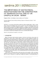
The Importance of Geotechnical Investigations for the Construction of Transfer Station „Prelići“ on Landfill in Cacak – Serbia
For the purpose of the facilities construction within the transfer station „Prelici“ in Cacak, specific geotechnical investigations were carried out based on which the technological project with the facilities schedule was developed. Significant deviations in relation to the presented results were determined during earthworks, so the additional geotechnical investigation works were carried out. Since the new investigation works have determined a different cross section of the terrain, it was proposed to move the planned facilities which led to the ...... become the integral part of the inhabited area. The landfill covers an area of about 13.5 ha, and the estimated volume of disposed waste is about 1800000 m3. The landfill is formed in alluvial plane of the left valley side of the West Morava River, i. e. left valley side of the Atenica River, which ...
... eastern border of the landfill and which flows into the West Morava River in the landfill zone. Unfortunately, this is a very common case in many municipalities in Serbia, where city landfills are located next to the rivers or in their vicinity (Rakic, 2013). Until 1994 at the city landfill „Prelici“ ...
... waters in the terrain), as well as by the occasional rise in the groundwater level. Figure 3. Characteristic geotechnical cross sections of the terrain at the location of the transfer station In the central part of the landfill itself, which is outside the planned construction zone of the transfer ...Dragoslav Rakić, Irena Basarić, Jovana Janković, Tina Đurić. "The Importance of Geotechnical Investigations for the Construction of Transfer Station „Prelići“ on Landfill in Cacak – Serbia" in 17th International waste management and landfill symposium, Proceedings SARDINIA 2019, CISA Publisher (2019)
-
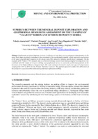
Synergy between the mineral deposit exploration and geothermal resources assessment on the example of "Valjevo" boron and lithium deposit in Serbia
Nebojša Atanacković, Vladimir Živanović, Ana Vranješ, Sava Magazinović, Marinko Toljić, Ana Arifović, Branislav Potić (2023)Exploration of mineral deposits involves a collection of vast data sets on geological characteristics of the area. These data can largely contribute to the assessment of the geothermal potential, which can lead to an increase in the share of geothermal resources in the energy mix of the extractive industry and the local community. On the example of the "Valjevo" B-Li deposit, data on structural settings and previous hydrogeological investigations were combined with the results of resource drilling and geophysical ...... 2.1. Study area The presented research is focused on the western part of the "Valjevo-Mionica" Miocene age basin (Figure 1). The "Valjevo" deposit is situated in the Kolubara River valley. The boron-lithium mineralization is hosted within the fine-grained, lacustrine sediment sequence (siltstone ...
... Kolubara River, Lower Triassic carbonate-clastic sediments dominate, with rare Middle Triassic limestones preserved in the cores of synclinal structures . South of the Kolubara River, the base of the Neogene basin is mainly made up of Middle Triassic limestones. Locally, there are minor occurrences of ...
... Lower Triassic sediments in the cores of the anticlinal folds. From the periphery of the basin, the Neogene's basal part descends deeper towards the axial part of the basin structure. The central part of the depression extends in the general direction ENE-WSW, whereby the basin is divided into several ...Nebojša Atanacković, Vladimir Živanović, Ana Vranješ, Sava Magazinović, Marinko Toljić, Ana Arifović, Branislav Potić. "Synergy between the mineral deposit exploration and geothermal resources assessment on the example of "Valjevo" boron and lithium deposit in Serbia" in Proceedings 9th International Conference mining and environmental protection, MEP23, Sokobanja, 24-27th May 2023, Beograd : Univerzitet u Beogradu, Rudarsko-geološki fakultet (2023)
-
Transboundary groundwater resources of Serbia - present status and future needs for sustainable management
Republic of Serbia is located at the crossroads of Southeast and Central Europe and belongs to the Central Balkans. With its 88,360 km2, Serbia is one of the larger countries of the Balkan Peninsula. It borders 8 countries and has at least one transboundary aquifer (TBA) with each of them. According to evaluation conducted for UNECE in 2008, Serbia has a total of 17 TBAs, out of which 15 are shared with one neighboring country, while two aquifers are shared with two or three ...Veljko Marinović, Branislav Petrović, Zoran Stevanović. "Transboundary groundwater resources of Serbia - present status and future needs for sustainable management" in Second International UNESCO Conference on Transboundary Aquifers, “ISARM2021: Challenges and the way forward”, Paris 2021, United Nations Educational, Scientific and Cultural Organization, 7, place de Fontenoy, 75352 Paris 07 SP, France (2021)
-
Хидрогеохемијске карактеристике и квалитет вода слива Требишњице, Република Српска, Босна и Херцеговина
Dragoslav R. Banjak (2016-08-25)Упркос неповољном временском и просторном распореду, воде су најзначајнијиприродни ресурс Источне Херцеговине. Ова чињеница довела је до реализацијепројекта „Вишенамјенског хидросистема Требишњица“, којим је, премаМилановићу (2006), до сада обухваћено: седам хидроелектрана, шестакумулација, шест брана, шест тунела укупне дужине 59,7 km, неколикоприступних тунела, 62,5 km бетонског канала кроз Попово поље, канал крозДабарско (6750 m) и Фатничко поље (2770 m) и систем тунел-канал или цјевоводпрема Дубравама.У почетку са доминантним енергетским предзнаком, концепција јетрансформисана у интегрално рјешење вишенамјенског коришћења и заштитевода и животне ...хидрогеохемијски процеси, мултиваријантна статистичкаанализа, инверзно геохемијско моделовање, квалитет воде, употребиљивост водеза наводњавање, слив Требишњице... between swallow holes the Trebišnjica river and the spring Omble, between swallow holes the Mušnica and the spring of the Trebišnjica river and in accumulation Gorica which is a place of mixing water from water accumulation Bileća, the river Sušica and the spring in Lastva. The results of modelling ...
... down the wastewater treatment plant and in the lower flow of the Mušnica river. The irrigation suitability of water in the river Trebišnjica catchment referring to the chemical composition is not balanced. To Allison's et al. classification (Allison et al, 1954) which is based on the value of ...
... modelling based on the example the Trebišnjica-Ombla showed that the mineral dissolution is the dominant hydrogeochemical process between the initial and final water and that's why open system is convenient to CO2. The spring of the Trebišnjica river shows modifying impact of Bileća accumulation on ...Dragoslav R. Banjak. "Хидрогеохемијске карактеристике и квалитет вода слива Требишњице, Република Српска, Босна и Херцеговина" in Универзитет у Београду, Универзитет у Београду, Рударско-геолошки факултет (2016-08-25)