Претрага
273 items
-

Characterization of bituminite in Kimmeridge Clay by confocal laser scanning and atomic force microscopy
Paul C. Hackley, Jolanta Kus, João Graciano Mendonça Filho, Andrew D. Czaja, Angeles G. Borrego, Dragana Životić, Brett J. Valentine, Javin J. Hatcheries (2022)This work investigates bituminite (amorphous sedimentary organic matter) in Upper Jurassic Kimmeridge Clay source rock via confocal laser scanning microscopy (CLSM) and atomic force microscopy (AFM). These petrographic tools were used to provide better understanding of the nature of bituminite, which has been historically difficult to identify and differentiate from similar organic matter types in source rocks. As part of an International Committee for Coal and Organic Petrology (ICCP) working group, an immature (0.42% vitrinite reflectance), organic-rich (44.1 wt% ...Битуминит, Kонфокална ласерска скенирајућа микроскопија, Mикроскопија атомских сила, Органска петрологија, Термичка зрелостPaul C. Hackley, Jolanta Kus, João Graciano Mendonça Filho, Andrew D. Czaja, Angeles G. Borrego, Dragana Životić, Brett J. Valentine, Javin J. Hatcheries. "Characterization of bituminite in Kimmeridge Clay by confocal laser scanning and atomic force microscopy" in International Journal of Coal Geology, Elsevier BV (2022). https://doi.org/10.1016/j.coal.2022.103927
-
Regional Slope Stability Analysis in Landslide Hazard Assessment Context, North Macedonia Example
Miloš Marjanović, Biljana Abolmasov, Igor Peshevski, James Reeves, Irena Georgievska. "Regional Slope Stability Analysis in Landslide Hazard Assessment Context, North Macedonia Example" in Understanding and Reducing Landslide Disaster Risk, Springer International Publishing (2020). https://doi.org/10.1007/978-3-030-60227-7_29
-
Determining seismic hazard in slowly deforming region: Can we gather enough information from karst caves?
Ana Mladenović, Jelena Ćalić (2021)Methods to determine seismic hazard in any region vary depending on the regional seismicity, but can be roughly grouped into two main groups: one based on probabilistic methods that use data about known seismicity in the region, and another, which is based on data related to the faulting processes and determination of seismically active faults. Both groups of methods are relatively good for seismically active regions. However, in regions of low seismic activity and slow deformations, there is neither ...Ana Mladenović, Jelena Ćalić. "Determining seismic hazard in slowly deforming region: Can we gather enough information from karst caves?" in EGU General Assembly 2021, European Geosciences Union (2021). https://doi.org/10.5194/egusphere-egu21-8723
-
Analysis of the Influence of Burden Deviation from the Designed One on the Intensity of the Blast Vibration
Stefan Milanović, Lazar Kričak, Milanka Negovanović, Nikola Simić, Jovan Marković, Nikola Đokić (2023)This paper presents an analysis of the influence of burden deviation from the designed one on the intensity of blasting vibrations through the use of laboratory and field examinations. By definition, the burden represents the shortest distance from the axis of an explosive column charge to the free surface. It should be measured along the entire hole length, although, in practice, it is often measured only on the bench surface as the shortest distance from the axis of the ...Stefan Milanović, Lazar Kričak, Milanka Negovanović, Nikola Simić, Jovan Marković, Nikola Đokić. "Analysis of the Influence of Burden Deviation from the Designed One on the Intensity of the Blast Vibration" in Applied Sciences, MDPI AG (2023). https://doi.org/10.3390/app132312837
-

Punctuated, episodic magmatism and mineralization of the Rogozna skarn-hosted Au-Zn-Pb-Cu deposits revealed through high-precision U-Pb zircon geochronology
The subvolcanic regions of magmatic centers are commonly associated with alteration, mineralization, and economic ore deposits, however the duration and frequency of mineralizing pulses within the overall lifespan of these centers can be poorly defined. Therefore, models for the formation of mineral systems require more highprecision geochronology data to refine their evolutionary models. Rogozna Mountain and its eponymous magmatic complex, located in SW Serbia, hosts multiple base metal deposits associated with variable rock types and structural expressions and serves as a natural laboratory to ...Skarnovska mineralizacija, Magmatsko-hidrothermalni sistemi, Subvulcanske intruzije, geohronologija na cirkonima, CA-ID-TIMSSean P. Gaynor, Milorad D. Antić, Vladica Cvetković, Kristina Šarić, Urs Schaltegger. "Punctuated, episodic magmatism and mineralization of the Rogozna skarn-hosted Au-Zn-Pb-Cu deposits revealed through high-precision U-Pb zircon geochronology" in Ore Geology Reviews, Elsevier (2023). https://doi.org/https://doi.org/10.1016/j.oregeorev.2023.105775
-
Стратешко планирање функционалности подземних просторија моделом прогнозе деформација
Лука Црногорац (2023)Релативно велике деформације подградне конструкције у подземним рудницима угља у Републици Србији представљају један од главних проблема за постизање планиране производње угља. Деформације подграде су директна последица статичких и динамичких оптерећења стенске масе и у многоме зависе и од времена трајања изложености подграде утицају подземног притиска. Код ниско механизованог радног процеса долази до повећаног излагања подземних просторија утицају подземног притиска услед дугог производног циклуса који је често пропраћен застојима у раду. Веома често подземне просторије се санирају и по ...Лука Црногорац. Стратешко планирање функционалности подземних просторија моделом прогнозе деформација, Београд : [Л. Црногорац], 2023
-
The Importance of Detailed Groundwater Monitoring for Underground Structure in Karst (Case Study: HPP Pirot, Southeastern Serbia)
... (alkaline water). Water temperatures were from 8.35 to 17 ◦C. The higher range (>12 ◦C, from 5 + 940 to 7 + 600 m) was measured in the deeper part of the rock mass along the contact of the main tectonic units (Vidlič thrust). Measurements of water losses at the control gate (Figure 4) showed an elevated water ...
... 4. Zhang, L.; Franklin, J.A. Prediction of Water Flow into RockTunnels: An Analytical Solution Assuming a Hydraulic Conductivity Gradient. Int. J. Rock Mec. Min. Sci. Geomech. Abstr. 1993, 30, 37–46. [CrossRef] 5. Font-Capó, J.; Vázquez-Suñé, E.; Carrera, J.; Martí, D.; Carbonell, R.; Pérez-Estaun, ...
... Eng. Geol. Environ. 2015, 75, 1617–1627. [CrossRef] 8. Zarei, H.R.; Uromeihy, A.; Sharifzadeh, M. Evaluation of hight lokal groundwater inflow to a rock tunnel by charactization of geological features. Tunn. Undergr. Space Technol. 2011, 26, 364–373. [CrossRef] 9. Chen, Y.F.; Hong, J.M.; Zheng, H.K ...Marina Čokorilo Ilić, Ana Mladenović, Marina Ćuk, Igor Jemcov. "The Importance of Detailed Groundwater Monitoring for Underground Structure in Karst (Case Study: HPP Pirot, Southeastern Serbia)" in Water, MDPI AG (2019). https://doi.org/10.3390/w11030603
-

Determining seismic hazard in slowly deforming region: Can we gather enough information from karst caves?
Ана Младеновић, Јелена Ћалић (2021)... suspectedthat some of these fault systems are also active in recent times. Relatively complex geological structure and existence of a large number of rock discontinuities, aswell as relatively long time during which these geological units have been exposed on the surface,led to intensive karst process ...Ана Младеновић, Јелена Ћалић. "Determining seismic hazard in slowly deforming region: Can we gather enough information from karst caves?" in EGU General Assembly 2021, European Geosciences Union (2021). https://doi.org/10.5194/egusphere-egu21-8723
-
Contribution to the geotechnical classification of municipal waste landfills in Serbia
Management, Monitoring, Policy and Law, Nature and Landscape Conservation, Geochemistry and Petrology, Waste Management and Disposal,Geotechnical Engineering and Engineering Geology,Water Science and Technology,Environmental Chemistry,Environmental EngineeringDragoslav Rakić, Irena Basarić, Laslo Čaki, Slobodan Ćorić. "Contribution to the geotechnical classification of municipal waste landfills in Serbia" in Environmental Geotechnics, Thomas Telford Ltd. (2018). https://doi.org/10.1680/jenge.18.00028
-
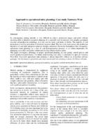
Approach to operational mine planning: Case study Tamnava West
... data base: • Checking of all 213 drill holes logs • Checking of all lithological intervals (11298 records), followed by lithological and ply / rock parting coding • Checking sample intervals, individual ply analysis and composite assays (5109 records, average sample length is 0.8m), • ...
... Figure 3. Lithology/coding chart In total there were 5109 drill hole samples taken from the 185 drill holes, 4045 coal samples and 1064 rock partings samples (dominantly clay). Analysis testing was conducted for Moisture, Ash, Lower (LVC) and Upper Calorific Value. After preliminary ...
... plies). The individual plies maintain relatively constant thickness over the strike length, while most of the variation takes place in the inner rock parting material mainly clay (Figure 5). Figure 5. Geological cross - section in Tamnava West 2.1.3. Ultimate pit design Long term production ...Dejan Stevanović, Mirjana Banković, Milica Pešić Georgiadis, Ranka Stanković. "Approach to operational mine planning: Case study Tamnava West" in Tehnika, Beograd : Savez inženjera i tehničara Srbije (2014). https://doi.org/10.5937/tehnika1406952S
-
Mineralogical study of clays from Dobrodo, Serbia, for use in ceramics
Maja Milošević, Predrag Dabić, Sabina Kovač, Lazar Kaluđerović, Mihovil Logar. "Mineralogical study of clays from Dobrodo, Serbia, for use in ceramics" in Clay Minerals, Mineralogical Society (2019). https://doi.org/10.1180/clm.2019.49
-

Jeleč grad- još nepriznati objekat geonasleđa
Остаци средњовековног града Јелеча на једном од врхова планине Рогозне (1262 m), по неким веровањима представљаju купу угашеног вулкана. Рогозна je позната по појавама скарновске Cu–Au минерализације, а трагови рударске активности и важних путева још од античких времена и даље постоје у непосредној околини. О томе сведочи и османски назив за Рогозну: Gümüş Dağ (Сребрна планина). Време изградње Јелеча је непознато. Постоје индиције да је постојао још у 6. веку, али се помиње први пут средином 12. века. Поуздан податак ...Marija Radisavljević, Danica Srećković Batoćanin, Vladan Vidosavljević, Irena Kajtez. "Jeleč grad- još nepriznati objekat geonasleđa" in Zbornik apstrakata, 212. 18. Kongres geologa Srbije "Geologija rešava probleme", Divčibare, 01-04 jun 2022, Srpsko geološko društvo (2022)
-
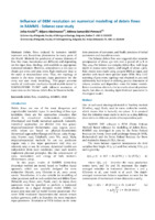
Influence of DEM resolution on numerical modelling of debris flows in RAMMS - Selanac case study
Debris flows induced by intensive rainfall represent very hazardous phenomena in many parts of the World. Methods for prediction of runout distance of flow like mass movements are different and depending on the input data, rheology, and available or appropriate numerical solution. However, sometimes it is not easy to obtain pre event and post event high-resolution data in the rural or mountainous area. Thus, the topology of terrain is the most important input parameter for the every real case ...... snow avalanches (Bartelt, 2015; Christen et al., 2007; 2010a; 2010b). Nevertheless, it is also suitable for modelling of other processes such as rock avalanches and debris flows (Schraml, 2015; Sosio, 2007; Frank, 2017). As input, three quantities must be specified to perform a numerical calculation: ...
... Hazards and Earth System Sciences 15 (7):1483-1492. Sosio R, Crosta GB, Hungr O (2008) Complete dynamic modeling calibration for the Thurwieser rock avalanche (Italian Central Alps). Engineering Geology 100 (1-2): 11-26. Takahashi T (2007) Debris Flow: Mechanics, Prediction and Countermeasures ...Jelka Krušić, Biljana Abolmasov, Mileva Samardžić Petrović. "Influence of DEM resolution on numerical modelling of debris flows in RAMMS - Selanac case study" in 4th Regional Symposium on Landslides in the Adriatic Balkan Region, 23-25 October 2019, Sarajevo, Bosnia and Herzegovina, Geotechnical Society of Bosnia and Herzegovina (2019). https://doi.org/ 10.35123/ReSyLAB_2019
-
Geoenvironmental Investigations at a Smelter Location in Bor (Serbia)
Petar Papić, Zvonimir Milijić, Jana Stojković, Jovana Milosavljević, Maja Todorović, Marina Ćuk, Željko Kamberović (2014)Petar Papić, Zvonimir Milijić, Jana Stojković, Jovana Milosavljević, Maja Todorović, Marina Ćuk, Željko Kamberović. "Geoenvironmental Investigations at a Smelter Location in Bor (Serbia)" in Challenges : Sustainable Land Management – Climate Change, Advances in Geoecology 43, Catena Verlag GMBH (2014)
-
Simple 2D gravity–density inversion for the modeling of the basin basement: example from the Banat area, Serbia
We have developed a technique to calculate lateral density distribution of the sedimentary basin basement by combining linear gravity–density inversion and 2D forward modeling. The procedure requires gravity anomaly data, depth-to-basement data and density data for the sediments (density–depth distribution). Gravity efect of density variations in the basement was extracted from the total gravity anomaly by removing the joint efect of the sediments with vertical density variations and homogeneous basement of average density contrast (calculated by 2D modeling). Gravity ...Ivana Vasiljević, Snežana Ignjatović, Dragana Đurić. "Simple 2D gravity–density inversion for the modeling of the basin basement: example from the Banat area, Serbia" in Acta Geophysica, Springer (2019). https://doi.org/10.1007/s11600-019-00328-9
-
From post-disaster landslides inventory to open landslides data
Biljana Abolmasov, Miloš Marjanović, Uroš Đurić, Jelka Krušić. "From post-disaster landslides inventory to open landslides data" in Proceedings of 3rd European Regional Conference of IAEG/ Athens/ Greece/ 6-10 October 2021, International Association for Engineering Geology and the Environment (2021)
-
Hydrogeochemistry of Uranium in the Groundwaters of Serbia
Marina Ćuk, Maja Todorović, Petar Papić, Jovan Kovačević, Zoran Nikić. "Hydrogeochemistry of Uranium in the Groundwaters of Serbia" in Uranium - Past and Future Challenges, Springer International Publishing Switzerland (2015). https://doi.org/10.1007/978-3-319-11059-2_89
-
Numerical modeling of Selanac debris flow propagation using SPH code
The Selanac debris flow is a very huge event triggered after extreme rainfall caused by Cyclone Tamara activity in the Republic of Serbia in May 2014. The Selanac case study was already modelling in different programs using Voellmy rheology assumptions like RAMMS software. In this paper research are focusing particularly on the process of debris flowing from initiation zone to main deposition area using Geoflow SPH two-phase model considering frictional rheology law. Main rheological parameters are back-calculated using also ...... , Tonni, L., Drempetic, V. (2008) ‘’Mathematical, constitutive and numerical modelling of catastrophic landslides and related phenomena’’. Rock Mech Rock Eng 41:85–132. Pastor, M., Blanc, T., Haddad, B. et al. (2014). ‘’Depth Averaged Models for Fast Landslide Propagation: Mathematical, Rheological ...Jelka Krušić, Biljana Abolmasov, Miloš Marjanović, Manuel Pastor, Saeid M. Tayyebi . "Numerical modeling of Selanac debris flow propagation using SPH code" in SCG-XIII International Symposium on Landslides. Cartagena, Colombia- February 22-26, 2021, International Society for Soil Mechanics And Geotechnical Engineering (2021)
-
Upotreba lidar tehnologije i digitalne fotogrametrije primenom iPhone pametnih telefona na primeru rudnika "Rudnik"
Nikola Mirković, Luka Crnogorac, Aleksa Paunović. "Upotreba lidar tehnologije i digitalne fotogrametrije primenom iPhone pametnih telefona na primeru rudnika "Rudnik"" in 15. Simpozijum „Rudarstvo 2024“ Održivi razvoj u rudarstvu i energetici, Vrnjačka banja, 21-24. maj 2024., Beograd : Institut za tehnologiju nuklearnih i drugih mineralnih sirovina (2024)
-
Review: Methodological approaches and research techniques for addressing construction and remediation problems in karst reservoirs
Saša Milanović, Ljiljana Vasić (2021)Saša Milanović, Ljiljana Vasić. "Review: Methodological approaches and research techniques for addressing construction and remediation problems in karst reservoirs" in Hydrogeology Journal, Springer Science and Business Media LLC (2021). https://doi.org/10.1007/s10040-020-02280-1