Претрага
259 items
-

Paleomagnetic evidence for post-collisional Miocene clockwise rotation in the Serbian segment of the Vardar Zone and the Danubicum
Vesna Lesić, Emő Márton, Vesna Cvetkov, Dragana Tomić. "Paleomagnetic evidence for post-collisional Miocene clockwise rotation in the Serbian segment of the Vardar Zone and the Danubicum" in 26th IUGG General Assembly Prague, Czech Republic, International Union of Geodesy and Geophysics (2015)
-
The analysis of the geothermal energy capacity for power generation in Serbia
Jana Stojković, Goran Marinković, Petar Papić, Mihailo Milivojević, Maja Todorović, Marina Ćuk (2013)... 6730 km under the surface. The Earth's crust is comparatively cold, except for the hot spots where magma is nearer the surface, and grows warmer with the depth. As to the utilization of the planet's heat, the efficiency of heat conversion into a form of beneficial energy as defined by the second law ...
... better use of the low-temperature fluids within the range from 100 °C to 175 °C. In a binary plant, the hot-water circuit passing through the thermal source is separated from the closed loop working fluid used in the turbine by a heat exchanger. The hot water gives up its heat in the heat exchanger ...
... drying plant. A pilot plant was installed in the heat-exchange station at the Gejzir Hotel of Sijarinska Banja. The heat power avail- able to the industry was 2.5 MW from thermal water pumped at the rate of only 15 l/s. At the maximum rate of 30 l/s, the available heat power would be 5 MW. Milojevi} ...Jana Stojković, Goran Marinković, Petar Papić, Mihailo Milivojević, Maja Todorović, Marina Ćuk. "The analysis of the geothermal energy capacity for power generation in Serbia" in Thermal Science, National Library of Serbia (2013). https://doi.org/10.2298/TSCI120215033S
-
Definisanje parametara čvrstoće na smicanje kod izvođenja kosina u ispucalom stenskom masivu
Zoran M. Berisavljević (2016-04-01)Definisanje parametara čvrstoće na smicanje ispucalih stenskih masa predstavlja jedanod najzahtevnijih zadataka mehanike stena. Geotehnička istraživanja su uglavnomograničena na rezultate laboratorijskih ispitivanja malih makroskopski homogenihuzoraka, sa kojih se vrši ekstrapolacija rezultata na terensku razmeru. Ispitivanja semogu vršiti in situ, ali su i ona ograničena veličinom korišćene aparature imikrolokacijom na kojoj se vrše ispitivanja. Pored toga, moguće je vršiti različitaispitivanja na fizičkim modelima, koja su veoma složena i skupa. Ekstrapolacijapodataka sa malog uzorka na terensku razmeru daje mnogo bolje rezultate ...naponsko stanje, ispucalost, heterogenost, čvrstoća na smicanje, geološki indeksčvrstoće, Hoek-Brownov materijal, kompozitni uzorci, dezintegracija, povratna analizaZoran M. Berisavljević. "Definisanje parametara čvrstoće na smicanje kod izvođenja kosina u ispucalom stenskom masivu" in Универзитет у Београду, Универзитет у Београду, Рударско-геолошки факултет (2016-04-01)
-
Regionalna karakterizacija karstnih podzemnih voda dela centralnog Balkana u funkciji njihovog održivog korišćenja i menadžmenta
Veljko J. Marinović (2022)Karstne podzemne vode koristi oko 700 miliona ljudi na svetu, čime je njihov značaj za svetsko stanovništvo nemerljiv. U sklopu doktorske disertacije vršena su istraživanja i analize karstnih sistema dela centralnog Balkana (Srbije, Crne Gore i Savskog sliva Bosne i Hercegovine), kako bi se evaluirao ovaj dragoceni resurs. Analize su vršene na primerima karstnih sistema vrela Perućac, Seljašnica, Mokra i Mlava (Srbija), Oko Bijele i Rijeka Crnojevića (Crna Gora) i vrelo Bosne (Bosna i Hercegovina), kao i na regionalnom ...karstni sistem, podzemna voda, pritisci na kvantitet i kvalitet, menadžment podzemnih vodnih resursaVeljko J. Marinović. Regionalna karakterizacija karstnih podzemnih voda dela centralnog Balkana u funkciji njihovog održivog korišćenja i menadžmenta, Beograd : [V. Marinović], 2022
-
Determination of the groundwater-leakage mechanism (binary mixing) in a karstic dam site using thermometry and isotope approach (HPP Visegrad, Bosnia, and Herzegovina)
Earth-Surface Processes,Geology, Pollution, Soil Science, Water Science and Technology, Environmental Chemistry, Global and Planetary ChangeLjiljana Vasić, Saša Milanović, Anita Puskás-Preszner, Laszlo Palcsu. "Determination of the groundwater-leakage mechanism (binary mixing) in a karstic dam site using thermometry and isotope approach (HPP Visegrad, Bosnia, and Herzegovina)" in Environmental Earth Sciences, Springer Science and Business Media LLC (2020). https://doi.org/10.1007/s12665-020-08910-x
-
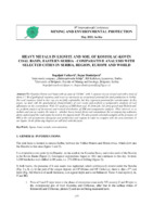
Heavy metals in lignite and soil of Kostolac-Kovin coal basin, eastern Serbia - comparative analysis with selected cities in Serbia, region, Europe and world
Bogoljub Vučković, Bojan Dimitrijević (2023)The Kostolac-Kovin coal basin with an area of 320 km2, with 5 separate layers of coal and with a total of about 5.7 Bt of geological resources and reserves represents an exceptional potential for coal production in Serbia. The coal resources listed in this way are not fully exploitable, but they represent potential for consideration. In this paper, we deal with the geochemical characteristics of coal seams and perform a comparative analysis of coal affectation on the environment. With ...... Figure 2. General overview of exploration wells (black dots) for the period 1941-2022. years in the Kostolac-Kovin coal-bearing basin, blue thick line — river Danube, blue thin line left – river Pelika Morava, blue thin line center — river Mlava, gray circle - uhderwater mining of Kovin lignite 178 ...
... 7. Presentation of the content of Zn, Pb and Cu in the urban, recreational and industrial top soil in the cities of the region; yellow – I, II and II Kostolac coal, black - the most polluted soil Figure 7 shows that the contents of Zn, Pb, Cu in the top soil in the cities of the region behave almost ...
... of the content of Zn, Pb and Cu in the urban and recreational top soil in the cities ofthe Furope; yellow – I, H and II Kostolac coal, black - the most polluted soil Figure 8 shows that the contents of Zn, Pb, Cu in the top soil of the cities in the Europe behave almost identically as in the previous ...Bogoljub Vučković, Bojan Dimitrijević. "Heavy metals in lignite and soil of Kostolac-Kovin coal basin, eastern Serbia - comparative analysis with selected cities in Serbia, region, Europe and world" in 9th International Conference Mining and Environmental Protection, 24–27. May 2023, Sokobanja, Beograd : Univerzitet u Beogradu, Rudarsko-geološki fakultet (2023)
-
Clockwise rotation in the Serbian segment of the Vardar zone and in the Danubicum of Eastern Serbia - tetonic implication
Vesna Lesić, Emo Marton, Vesna Cvetkov, Dragana Tomić. "Clockwise rotation in the Serbian segment of the Vardar zone and in the Danubicum of Eastern Serbia - tetonic implication" in 5. Hrvatski geološki kongres. Abstract Book 5th Croatian Geological Congress, Hrvatski geološki institut (2015)
-
Determining the Groundwater Balance and Radius of Influence Using Hydrodynamic Modeling: the Case Study of the Groundwater Source “Šumice” (Kikinda, Serbia)
A groundwater flow model was developed to simulate groundwater extraction from the public water supply source of the City of Kikinda. The hydrodynamic model includes the municipal groundwater source of Kikinda (Šumice and the Jezero Well), but also an extended area where there are groundwater sources that provide water supply to three factories: (MSK, TM and LŽT - Kikinda). Hydrodynamic modeling, based on the numerical method of finite differences will show the groundwater balance of the sources in the ...... also recharged from surface water in the southwestern part of the area, where the depth of the layers which from the aquifer is relatively small and allows a hydraulic contact between the river and the aquifer over the alluvial layers. The main types of aquifer drainage are: artificial drainage ...
... period, during the Holocene: abandoned channel facies, floodplain facies, bog sediments, alluvia, and the youngest unit deposited since the Holocene – the beach facies of the Tisa River. Sedimentological analyses have shown that they were mostly made up of alevrites, sand, gravel and loess. HYDR ...
... sediments is about 30 m. The aquifer is rechared by infiltration of precipitation and surface water, since there is a good hydraulic contact between the aquifer and the river. The aquifer is drained naturally, at times of low river stages when groundwater flow is directed towards rivers, and artificially ...Dušan Polomčić, Dragoljub Bajić, Jelena Zarić. "Determining the Groundwater Balance and Radius of Influence Using Hydrodynamic Modeling: the Case Study of the Groundwater Source “Šumice” (Kikinda, Serbia)" in Journal of Sustainable Development of Energy, Water and Environment Systems (2015). https://doi.org/10.13044/j.sdewes.2015.03.0017
-
Long-term rockslope monitoring and rockfall prediction
Miloš Marjanović, Biljana Abolmasov, Marko Pejić, Jelka Krušić. "Long-term rockslope monitoring and rockfall prediction" in Proceedings of 3rd European Regional Conference of IAEG/ Athens/ Greece/ 6-10 October 2021, International Association for Engineering Geology and the Environment (2021)
-
Regional Slope Stability Analysis in Landslide Hazard Assessment Context, North Macedonia Example
Miloš Marjanović, Biljana Abolmasov, Igor Peshevski, James Reeves, Irena Georgievska. "Regional Slope Stability Analysis in Landslide Hazard Assessment Context, North Macedonia Example" in Understanding and Reducing Landslide Disaster Risk, Springer International Publishing (2020). https://doi.org/10.1007/978-3-030-60227-7_29
-
Replica of the “Great Triangle Gold Nugget” Belonging to Belgrade University Collection, Gilded or Not?
... Tachkou-Targanka river in 1842. At the time of its invention, the whole area of Zlatoust was the most significant in the world with its gold mines (JONES, 1844). Today, this unique native gold nugget adorns showcases with numerous unique exhibits in the Diamond Fund display in Moscow, Russia, Kremlin ...
... finding, the weight of the natural nugget (Archive of the Collection of Rocks and Minerals), but with no information of the number of the replica made, and the type and manner of material that was used for covering. Result and conclusion The data obtained by EDS analysis show that the gypsum ...
... removed from the surface and glued onto a graphite strip, without covering. Chemical analysis was performed on unpolished pieces, using the EDS detector and the internal standards. Historic background The gold nugget was mined in the Southern Ural, in the gold-bearing sands of the Tachkou-Targanka ...Alena Zdravković, Maja Milošević, Ivana Jelić. "Replica of the “Great Triangle Gold Nugget” Belonging to Belgrade University Collection, Gilded or Not?" in 8th Mineral Sciences in the Carpathians Conference, Acta Mineralogica-Petrographica, Miskolc, Hungary, Department of Mineralogy, Geochemistry and Petrology, University of Szeged, Szeged, Hungary (2021)
-
Određivanje prostorne distribucije vrednosti hidrauličkih parametara izdani: primer površinskog kopa „Radljevo“
Najčešće se kalibracija hidrodinamičkih modela vršila manuelno - „probanjem“ sa različitim vrednostima hidrauličkih parametara i hidrauličkih karakteristika graničnih uslova. Ovakav način rada zahteva veliko znanje i iskustvo eksperta, pri čemu ostaje otvoreno pitanje da li dobijeno rešenje ima optimalan skup parametara. Primenom optimizacione metode, koja se zasniva na Gauss-Marquardt-Levenberg-ovom algoritmu, i PEST softvera, ...Dragoljub Bajić, Dušan Polomčić, Jelena Ratković, Predrag Pajić. "Određivanje prostorne distribucije vrednosti hidrauličkih parametara izdani: primer površinskog kopa „Radljevo“" in 9. Međunarodni simpozijum o upravljanju podzemnim resursima, Zaječar 2019., Megatrend Univerzitet, Fakultet za menadžment, Zaječar (2019)
-
Application of a Method for Intelligent Multi-Criteria Analysis of the Environmental Impact of Tailing Ponds in Northern Kosovo and Metohija
Gordana Milentijević, Blagoje Nedeljković, Milena Lekić, Zoran Nikić, Ivica Ristović, Jelena Đokić (2016)... water from the tailing pond of the landfill through collectors was placed there when the landfill was constructed, releasing waste into the Ibar River. The tailings are still not managed properly [11]. Flotation landfill Gornje Polje (Figure 2a) is placed on the Ibar River bank, on the part of the terrain ...
... flows. Tailing material from the analyzed deposits shows permanent toxic pollution of water and agricultural land [13]. All atmospheric water and waters from tailing ponds are released into the Ibar River through drainage systems in the tailings. The water bodies from the area as well as those from remote ...
... bank of the Ibar River. Flotation tailings from mines Belo Brdo, Crnac, Koporić, Žuta Prlina and Jelakce were deposed there. Surface of the landfill is around 7 ha and on it are approximately 2,600,000 t of deposed tailings. The landfill dam has several steep slopes. Tailing is placed at the bottom of ...Gordana Milentijević, Blagoje Nedeljković, Milena Lekić, Zoran Nikić, Ivica Ristović, Jelena Đokić. "Application of a Method for Intelligent Multi-Criteria Analysis of the Environmental Impact of Tailing Ponds in Northern Kosovo and Metohija" in Energies, MDPI AG (2016). https://doi.org/10.3390/en9110935
-
Paleomagnetic study of Jurassic-Early Cretaceus sediments in the Danibicum of Eastern Serbia
... 2011: Paleomagnetism of the Latest Oligocene – Miocene extrusive igneous rocks from the Vardar zone and from the Serbian part of the Pannonian basin. The 4th international workshop on the Neogene from the central and south-eastern Europe, Abstracts and Guide of the Excursion, Slovak Republic ...
... were isolated. The statistical parameters on locality level are usually excellent. Both the present and the earlier studies in Romania for the Jurassic defined remanences of post- deformational age. The overall mean direction for the Danubicum is well defined and similar to those for the Vardar zone ...
... was studied earlier for paleomagnetism. The aim of our study was to find out if the study area was involved in regional displacement during or after the time covered by the samples. We sampled 8 localities of Late Jurassic and Early Cretaceous limestones. The cores were oriented in situ using geological ...Vesna Cvetkov, Emo Marton, Vesna Lesić, Dragana Tomić. "Paleomagnetic study of Jurassic-Early Cretaceus sediments in the Danibicum of Eastern Serbia" in I Kongres geologa u Bosni i Hercegovini sa međunarodnim učešćem, Udruženje geologa u Bosni i Hercegovini (2015)
-
Pleistocene rhinoceros from Bogovina Cave: the first report of Stephanorhinus hundsheimensis Toula, 1902 (Mammalia, Rhinocerotidae) from Serbia
Finds of Pleistocene rhinoceros are rare in Serbia, and only one species (the woolly rhinoceros Coelodonta antiquitatis Blumenbach, 1799) has been reported so far. The current paper presents the dental material of an extinct so-called Hundsheim rhinoceros, Stephanorhinus hundsheimensis Toula, 1902 from Bogovina Cave (East ern Serbia). Both the morphological and metric characteristics of the teeth are consis tent with the attribution to S. hundsheimensis. Unfortunately, the rhinoceros material originated from an uncertain geological context, so there is no ...... F., Sala, B., Tremolada, F., Francou, C., and Raineri, G. 2016. Insights on the opening of the Galerian mammal migration pathway from magnetostratigraphy of the Pleistocene marine-continental transition in the Arda River section (northern Italy). Quaternary Research, 86:220-231. https://doi.org/10 ...
... Bona, F. and Sala, B. 2016. Villafranchian-Galerian mammal faunas transition in South-Western Europe. The case of the late Early Pleistocene mammal fauna of the Frantoio locality, Arda River (Castell’Arquato, Piacenza, Northern Italy). Geobios, 49:329-347. https://doi.org/ 10.1016/j.geobios.2016 ...
... (zebroid) and the caballoid (true) horses. The most obvious dental differences between the two groups can be seen in the lower cheek teeth, namely, in the mor- phology of the metaconid-metastylid loops (the double knot) and in the shape of the entoflexids (i.e., linguaflexid sensu Skinner et al., 1972) ...Predrag Radović, Miloš Radonjić, Emmanuel Billia. "Pleistocene rhinoceros from Bogovina Cave: the first report of Stephanorhinus hundsheimensis Toula, 1902 (Mammalia, Rhinocerotidae) from Serbia" in Palaeontologia Electronica, Coquina Press (2020). https://doi.org/10.26879/985
-
An arid phase in the Internal Dinarides during the early to middle Miocene: Inferences from Mg-clays in the Pranjani Basin (Serbia)
N. Andrić-Tomašević, V. Simić, O. Mandic, D. Životić, M. Suárez, E. García-Romero. "An arid phase in the Internal Dinarides during the early to middle Miocene: Inferences from Mg-clays in the Pranjani Basin (Serbia)" in Palaeogeography, Palaeoclimatology, Palaeoecology, Elsevier BV (2020). https://doi.org/10.1016/j.palaeo.2020.110145
-
Influence of DEM resolution on numerical modelling of debris flows in RAMMS - Selanac case study
Debris flows induced by intensive rainfall represent very hazardous phenomena in many parts of the World. Methods for prediction of runout distance of flow like mass movements are different and depending on the input data, rheology, and available or appropriate numerical solution. However, sometimes it is not easy to obtain pre event and post event high-resolution data in the rural or mountainous area. Thus, the topology of terrain is the most important input parameter for the every real case ...... Selanačka river valley. Generally it is necessary for further research to testing model with influence of the torrential flood on the deposition zone in the same time as Selanac debris flow. Also it is supposed that using some type of 2-phase numerical models potentially could provide more accurate results ...
... where ρ is the mass density, g is the gravitational acceleration,𝜑 is the slope angle, and Hgcos 𝜑 is the normal stress on the overflowed surface. The tangent of the effective internal friction angle of the flow material can be defined for the resistance of the solid phase (the term containing ...
... 2010b). The frictional deceleration Sf of the flow is determined using the Voellmy friction relation (Salm et al., 1990; Salm, 1993) and specifies the dry-Coulomb term (friction coefficient / scaling with the normal stress and the viscous or turbulent friction (coefficient/ depending on the flow velocity ...Jelka Krušić, Biljana Abolmasov, Mileva Samardžić Petrović. "Influence of DEM resolution on numerical modelling of debris flows in RAMMS - Selanac case study" in 4th Regional Symposium on Landslides in the Adriatic Balkan Region, 23-25 October 2019, Sarajevo, Bosnia and Herzegovina, Geotechnical Society of Bosnia and Herzegovina (2019). https://doi.org/ 10.35123/ReSyLAB_2019
-
Machine learning based landslide assessment of the Belgrade metropolitan area: Pixel resolution effects and a cross-scaling concept
Improvements of Machine Learning-based landslide prediction models can be made by optimizing scale, customizing training samples to provide sets with the best examples, feature selection, etc. Herein, a novel approach, named Cross-Scaling, is proposed that includes the mixing of training and testing set resolutions. Hypothetically, training on a coarser resolution dataset and testing the model on a finer resolution should help the algorithm to better generalize ambiguous examples of landslide classes and yield fewer over/underestimations in the model. This ...Uroš Đurić, Miloš Marjanović, Zoran Radić, Biljana Abolmasov. " Machine learning based landslide assessment of the Belgrade metropolitan area: Pixel resolution effects and a cross-scaling concept" in Engineering Geology , Elsevier (2019). https://doi.org/10.1016/j.enggeo.2019.05.007
-
Age And Mode of the Middle Miocene Marine Flooding of the Pannonian Basin—Constraints from Central Serbia
Oleg Mandic, Ljupko Rundić, Stjepan Ćorić, Ðurðica Pezelj, Dörte Theobalt, Karin Sant, Wout Krijgsman (2019)The timing and mode of the marine flooding of the southern margin of the Pannonian basin in SE Europe is still a matter of debate. In central Serbia, integrated bio-magnetostratigraphic data and quantified high-resolution records are completely missing. Here, we provide paleoenvironmental and paleoecological constraints from the Slanci section located near Belgrade that has an excellent preservation of micro-fauna and flora, i.e., planktonic and benthic foraminifera and calcareous nannoplankton. We integrate their quantified records with sedimentological, natural gamma radioactivity ...Oleg Mandic, Ljupko Rundić, Stjepan Ćorić, Ðurðica Pezelj, Dörte Theobalt, Karin Sant, Wout Krijgsman. "Age And Mode of the Middle Miocene Marine Flooding of the Pannonian Basin—Constraints from Central Serbia" in PALAIOS, Society for Sedimentary Geology (2019). https://doi.org/10.2110/palo.2018.052
-
Hydrochemical changes and groundwater grouping data by multivariate statistical methods within one karst system: recharge–discharge zone (Eastern Serbia case study)
Ljiljana Vasić, Dragana Živojinović, Vladana Rajaković-Ognjanović. "Hydrochemical changes and groundwater grouping data by multivariate statistical methods within one karst system: recharge–discharge zone (Eastern Serbia case study)" in Carbonates and Evaporites, Springer Science and Business Media LLC (2020). https://doi.org/10.1007/s13146-019-00548-6