Претрага
259 items
-
Arsenic in Tap Water of Serbia´s South Pannonian Basin and Arsenic Risk Assessment
Petar Papić, Marina Ćuk, Maja Todorović, Jana Stojković, Bojan Hajdin, Nebojša Atanacković, Dušan Polomčić (2012)... direction, from the eastern edges of the Alps in Austria and Slovenia to the Carpathian Mountains in Romania. In the south, the basin is bordered by the North Dinarides in Croatia, Bosnia and Herzegovina, and Serbia, and in the north by the Tatras in Slovakia. The Danube River is also the western boundary ...
... DAN N., GIGER W., STÜBEN D. Hydrological and sedimentary controls leading to arsenic contamination of groundwater in the Hanoi area, Vietnam: The impact of iron-arsenic ratios, peat, river bank deposits, and excessive groundwater abstraction, Chem. Geol., 249, (1-2), 91, 2008. 5. SUN G.F., PI J.B., LI ...
... was esti- mated using four parameters: the concentration of As in the groundwater . The cumulative As exposure index (CAI) was estimated using four parameters: the concentration of As in the groundwater (Cwater), the age of the well (exposure duration, ED), the annual ingestion rate of groundwater (frequency ...Petar Papić, Marina Ćuk, Maja Todorović, Jana Stojković, Bojan Hajdin, Nebojša Atanacković, Dušan Polomčić. "Arsenic in Tap Water of Serbia´s South Pannonian Basin and Arsenic Risk Assessment" in Polish Journal of Environmental Studies (2012)
-
Properties of fly ash and slag from the power plants
This paper describes the physical, chemical and mineral properties of ash and slag, which were taken from thermal power plants Nikola Tesla A, Nikola Tesla B, Kostolac A and Kostolac B. The knowledge of the mineralogical material composition is important because the type of minerals directly determines the properties of the fly ash and slag and their possible application. Laboratory tests showed that ash and slag samples consist of the following minerals: amorphous materials, quartz, feldspar, mullite, melilite, cristobalite, ...fly ash, slag, physical composition, chemical composition, mineral composition, X-ray diffraction method... PPNT A is the most important producer of electricity in Serbia and is built on the bank of the river Sava. PPNT A is 4 km from Obrenovac, PPNT B is located 16 km upstream from PPNT A (Fig. 1). Both PPNT use coal from the Kolubara basin. The Kolubara lignite basin is economically one of the most important ...
... generation (ŽIVOTIĆ et al., 2013). In the Kostolac coal basin two thermal power plants were built. PPKO A is located on the right bank of the river Danube, Figure 2. Geological map of the Kolubara basin (from ŽIVOTIĆ et al., 2013). Figure 1. Map of the study area (www.maps.google.com). G eo ...
... seams is about 6km2. The northern border is represented by outcropping and erosion of the Main coal seam. The western border of the deposit is a natural extension to the G field and the southern boundary to the E field. The eastern border is also marked by outcropping of the Main coal seam (ŽIVOTIĆ ...Miloš Šešlija, Aleksandra Rosić, Nebojša Radović, Milinko Vasić, Mitar Đogo, Milovan Jotić. "Properties of fly ash and slag from the power plants" in Geologia Croatica, Zagreb : Croatian Geological Survey (2016). https://doi.org/10.4154/gc.2016.26
-
Serbian NER&Beyond: The Archaic and the Modern Intertwinned
U ovom radu predstavljamo srpski književni korpus koji se razvija pod okriljem COST Akcije „Distant Reading for European Literary History” CA16204. Koristeći ovaj korpus romana napisanih pre više od jednog veka, razvili smo i učinili javno dostupnim Sistem za prepoznavanje imenovanih entiteta (NER) obučen da prepozna 7 različitih tipova imenovanih entiteta, sa konvolucionom neuronskom mrežom (CNN), koja ima F1 rezultat od ≈91% na test skupu podataka. Ovaj model je dalje ocenjen na posebnom skupu podataka za evaluaciju. Završavamo poređenje ...... name of the river – we retained only the possibility appropriate to the particular novel). The EVENT named entity is somewhat spe- cial: SrpNER does not recognize this entity, so the evaluators were asked to identify and anno- tate them when they occur in text. SrpNER does not recognize WORK entity either ...
... (“mountain”, “river”, “lake”, etc.). ENE also included some new NE types like “products”, “event”, “position”, etc. Dekker et al. (2019) experimented with diffe- rent off-the-shelf NER tools for the extraction of social network graphs from classic and mo- dern English fiction novels. The authors wan- ...
... SrpELTeC corpus7 in the latest EL- TeC release has 90 novels. The work on this collection is still in progress with the aim to obtain the complete collection by the end of the project. Contrary to a number of other Eu- ropean languages involved in this action, the Serbian corpus is being produced from scratch ...Branislava Šandrih Todorović, Cvetana Krstev, Ranka Stanković, Milica Ikonić Nešić. "Serbian NER&Beyond: The Archaic and the Modern Intertwinned" in Proceedings of the Conference Recent Advances in Natural Language Processing - Deep Learning for Natural Language Processing Methods and Applications, INCOMA Ltd. Shoumen, BULGARIA (2021). https://doi.org/10.26615/978-954-452-072-4_141
-

Definition of groundwater genesis and circulation conditions of the complex hydrogeological karst system Mlava–Belosavac–Belosavac-2 (eastern Serbia)
Ljiljana Vasić, Saša Milanović, Zoran Stevanović, Laszlo Palcsu. "Definition of groundwater genesis and circulation conditions of the complex hydrogeological karst system Mlava–Belosavac–Belosavac-2 (eastern Serbia)" in Carbonates and Evaporites, Springer Science and Business Media LLC (2020). https://doi.org/10.1007/s13146-020-00550-3
-
Hidrodinamička analiza procesa starenja bunara sa horzontalnim drenovima na beogradskom izvorištu podzemnih voda
Đorđije M. Božović (2023)Predmet istraživanja doktorske disertacije su bunari sa horizontalnim drenovima beogradskog izvorišta podzemnih voda, drugog najvećeg izvorišta ovog tipa na svetu, čiji je režim rada opterećen procesima intenzivnog starenja prisutnog od samog početka formiranja izvorišta, početkom 1950‒ih godina. Istraživanja sprovedena u okviru izrade disertacije su imala za cilj definisanje nove metodologije izučavanja procesa mehaničkog i biohemijskog kolmiranja drenova izradom detaljnih 3D numeričkih hidrodinamičkih modela, upotrebom postojećih, dostupnih i široko rasprostranjenih računarskih programa. Istraživanja su realizovana simulacijom ostvarenog režima podzemnih voda ...modeliranje podzemnih voda, hidrauličke karakteristike drenova, koeficijent propusnosti drenova, prifilterska zona drena, hidraulički otpori na drenovima, kolmiranje drenova, ulazne brzine podzemnih voda, MODFLOW, CLN Package... Interference of radial collector well adjacent to river bank. Symposium of International assoc. of scientific hydrology, Athens. 131 Milojević M., 1963a. Radial collector wells adjacent to the riverbank. Journal of the Hydraulics Division, Proceedings of the American Society of Civil Engineers, 89(6) ...
... –02. 10. 2022., Zlatibor. 173 Przybyłek, J., Dragon, K., Kaczmarek, P.M.J., 2017. Hydrogeological investigations of river bed clogging at a river bank filtration site along the River Warta, Poland. Geologos 23, 3, 201–214. DOI: 10.1515/logos-2017-0021 174 Pušić M., Dimkić M., Vidović D., Dotlić ...
... 1935. The Thiem method for determining permeability of water‒bearing materials. U.S. Department of the Interior, Geological Survey, Water Supply Paper. DOI: 10.3133/wsp679A 215 Wett, B., Jarosch, H., Ingerle, K., 2002. Flood induced infiltration affecting a bank filtrate well at the River Enns, ...Đorđije M. Božović. Hidrodinamička analiza procesa starenja bunara sa horzontalnim drenovima na beogradskom izvorištu podzemnih voda, Beograd : [Đ. Božović], 2023
-
The subthermal potential of karstic groundwater of Kučaj–Beljanica region in Serbia estimated by the multivariate analysis
Earth-Surface Processes, Geology, Pollution, Soil Science, Water Science and Technology, Environmental Chemistry, Global and Planetary ChangeLjiljana Vasić, Dragana Ž. Živojinovic, Vladana Rajaković-Ognjanović, Huang Fen, Cao Jianhua. "The subthermal potential of karstic groundwater of Kučaj–Beljanica region in Serbia estimated by the multivariate analysis" in Environmental Earth Sciences, Springer Science and Business Media LLC (2021). https://doi.org/10.1007/s12665-021-09392-1
-
Mineral Resources of Serbia: Environmental, Societal and Economic Challenges
... (RHMSS, 2012). The most widespread soil types are Cambisol and Chernozem and fluvisols near the river basins. Chernozem is the dominant soil type, especially in the northern part of Serbia, which belongs to the Panonnian lowland. The soil types are grouped (Table 1) based on the FAO 2006 clas ...
... study examining the contamination of the Danube River, have pointed out that the traces of trimethoprim, carbamazepine, metamizole metabolite and lorazepam found in the water are a result of the fact that the wastewater in Serbia is rarely treated prior to being discharged into the environment (Radović ...
... due to the lack of environmental legislation, lack of advanced treatment technologies and accidental spills (Teodorović 2009). The Danube River Basin receives about 80% of the wastewater from industry (Kolarević et al. 2011), and what is particularly worrying is the fact that the river water ...Vladimir Simić, Rade Jelenković, Dragana Životić. "Mineral Resources of Serbia: Environmental, Societal and Economic Challenges" in Serbia: Current Issues and Challenges in the Areas of Natural Resources, Agriculture and Environment,, Nova Science Publishers, Inc. (2019)
-
Mikroelementi u uljnim šejlovima Aleksinca i njihov uticaj na životnu sredinu
Nikoleta Aleksić (2021)... fish species from the Sava River and risk assessment for consumers. Science of the Total Environment, 650, 958-969. [3] Kostić, J., Kolarević, S., Kračun-Kolarević, M., Aborgiba, M., Gačić, Z., Paunović, M., ... & Vuković-Gačić, B. (2017). The impact of multiple stressors on the biomarkers response ...
... heavy metals in fishes in the middle and lower reaches of the Yangtze River basin. Environmental Pollution, 159(10), 2575-2585. [28] Zheng, N., Wang, Q., Zhang, X., Zheng, D., Zhang, Z., & Zhang, S. (2007). Population health risk due to dietary intake of heavy metals in the industrial area of Huludao ...
... assessment and apportionment of pollution sources of Tigris River (Turkey) using, multivariate statistical techniques – a case study, River Res. Applic. 28(9):1428–1438 [12] Kibria, G. (2004). Environmental update-Dissolved oxygen: The facts. Outlet. Issue 162. pages 2-4. [13] Zhu, Z., Guan, X. ...Nikoleta Aleksić. "Mikroelementi u uljnim šejlovima Aleksinca i njihov uticaj na životnu sredinu" in VIII Memorijalni naučni skup iz zaštite životne sredine „Docent dr Milena Dalmacija“, 2021, Prirodno-matematički fakultet, Novi Sad (2021)
-
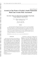
Arsenic in tape waters of the south Pannonian basin (Serbia) and arsenic risk assessment
Petar Papić, Marina Ćuk, Maja Todorović, Jana Stojković, Bojan Hajdin, Nebojša Atanacković, Dušan Polomčić (2012)... direction, from the eastern edges of the Alps in Austria and Slovenia to the Carpathian Mountains in Romania. In the south, the basin is bordered by the North Dinarides in Croatia, Bosnia and Herzegovina, and Serbia, and in the north by the Tatras in Slovakia. The Danube River is also the western boundary ...
... DAN N., GIGER W., STÜBEN D. Hydrological and sedimentary controls leading to arsenic contamination of groundwater in the Hanoi area, Vietnam: The impact of iron-arsenic ratios, peat, river bank deposits, and excessive groundwater abstraction, Chem. Geol., 249, (1-2), 91, 2008. 5. SUN G.F., PI J.B., LI ...
... was esti- mated using four parameters: the concentration of As in the groundwater . The cumulative As exposure index (CAI) was estimated using four parameters: the concentration of As in the groundwater (Cwater), the age of the well (exposure duration, ED), the annual ingestion rate of groundwater (frequency ...Petar Papić, Marina Ćuk, Maja Todorović, Jana Stojković, Bojan Hajdin, Nebojša Atanacković, Dušan Polomčić. "Arsenic in tape waters of the south Pannonian basin (Serbia) and arsenic risk assessment" in Polish Journal of Enivronmental Studies 21 no. 6, Olsztyn, Poland : Polish Journal of Enivronmental Studies (2012): 1783-1790
-
Hypogene speleogenesis related to porphyry magmatic intrusions and its influence on subsequent karst evolution in the Peruvian high Andes
Alexander Klimchouk, David Evans, Sasa Milanovic, Cristian Bittencourt, Mauro Sanchez, F. Carlos Aguirre (2022)Alexander Klimchouk, David Evans, Sasa Milanovic, Cristian Bittencourt, Mauro Sanchez, F. Carlos Aguirre. "Hypogene speleogenesis related to porphyry magmatic intrusions and its influence on subsequent karst evolution in the Peruvian high Andes" in Geomorphology, Elsevier BV (2022). https://doi.org/10.1016/j.geomorph.2022.108488
-
BEYOND 2020 - Geology explorations and open pit activities affectation in reclamation designing in Kolubara Coal Mines (KCM) Serbia, new considerations
Geology explorations in KCM runs from 1936. year up to these days and still ongoing. Results in >7,200 drill holes with ≈600,000 m of core drilling and gave lignite ore resources of > 4,1Bt, which 1,15Bt are excavated since 1986. of XIX up to early years of XXI century. For further mining operations in open pits stay 1,5Bt of lignite. Under waste heaps are ≈80 km2, additional 85 km2 should be filled. All of that masses/areas were, are ...Bojan Dimitrijević, Bogoljub Vučković, Radmila Gaćina. "BEYOND 2020 - Geology explorations and open pit activities affectation in reclamation designing in Kolubara Coal Mines (KCM) Serbia, new considerations" in 17th International Conference of the open and underwater mining of minerals, Sts. Constantine and Helena Resort, Varna, 18-22 September, Bulgaria, Sofia, Bulgaria : Scientific and Technical Union of Mining, Geology and Metallurgy, (2023)
-
Hydrogeochemistry of Uranium in the Groundwaters of Serbia
Marina Ćuk, Maja Todorović, Petar Papić, Jovan Kovačević, Zoran Nikić. "Hydrogeochemistry of Uranium in the Groundwaters of Serbia" in Uranium - Past and Future Challenges, Springer International Publishing Switzerland (2015). https://doi.org/10.1007/978-3-319-11059-2_89
-
Stratigraphy and microfossils (radiolarians and planktonic foraminifers) of the Upper Cretaceous (upper Santonian–lower Campanian) Struganik limestone (Western Serbia)
Liubov G. Bragina, Nikita Yu. Bragin, Ludmila F. Kopayevich, Nevenka Đerić, Nataša Gerzina Spajić (2019)Liubov G. Bragina, Nikita Yu. Bragin, Ludmila F. Kopayevich, Nevenka Đerić, Nataša Gerzina Spajić. "Stratigraphy and microfossils (radiolarians and planktonic foraminifers) of the Upper Cretaceous (upper Santonian–lower Campanian) Struganik limestone (Western Serbia)" in Palaeoworld, Elsevier BV (2019). https://doi.org/10.1016/j.palwor.2019.05.001
-
Development of integrated fuzzy model for mine management optimization
Miodrag Čelebić, Sanja Bajić, Dragoljub Bajić, Dejan Stevanović, Duško Torbica, Vladimir Malbašić (2023)... L-29C of the Bešpelj mine near Jajce in the Republic of Serbia, Bosnia and Herzegovina, which is the focus of the paper. Study area and geology. The Bešpelj bauxite mine is located on a spacious karst plateau, on the right bank of the Vrbas River. It is at a beeline distance of 10 km from the town ...
... defined and then the weight priority vectors determined, as described in Steps 1 through 5. Step 7. The final weights of the alternatives are determined by multiplying, the “weights” from the criteria matrix by the “weights” obtained under Step 6. The highest “weight” value represents the optimal a ...
... of Jajce to the north. The longer axis of deposit L-29C rends west-to-east (140 m), and the shorter axis is perpendicular (15 m long, apering out to 1 m in the east). The ore body is vertical. T'he deposit is close to he land surface, at a depth of about 100 m, and the quality of the bauxite ore ...Miodrag Čelebić, Sanja Bajić, Dragoljub Bajić, Dejan Stevanović, Duško Torbica, Vladimir Malbašić. "Development of integrated fuzzy model for mine management optimization" in Comptes rendus de l'Académie Bulgare des Sciences (2023)
-
Conversion of land areas after coal mine closure and reclamation
Otkopavanje uglja površinski i podzemno praćeno je degradacijom zemljišta, promenom formiranja predela i izmenom flore i faune. Od velikog značaja je razvoj novih naučno utemeljenih pristupa obnovljanje antropogeno poremećenih predela zasnovanih na formiranju rekultivacionih i rudarskih tehnologija. Apsolutno je neophodno obezbediti sveobuhvatno kvalitetno očuvanje zemljišnih i vodnih resursa i odrediti rekultivisano zemljište za novu namenu. U ovom članku je dat pregled najpopularnijih metoda rekultivacije zemljišta i mogućnosti rekultivacije zemljišta nakon završetka rekultivacije i zatvaranja rudnika uglja.... height 50 m. The landfill slopes have been reclaimed. The thickness of bulk overburden material is 40-50 m. The area belongs to “Drmno” open pit is in the eastern part of the Kostolac coal basin, 1.e., east of the Mlava River. (Figure 1) igure 1. Location of study area - Drmno The Kostolac mining ...
... topographical changes of the green space that would directly affect the degradation of agricultural lands. Predictions of the effects on the environment are very important and present the concern in the sense of the loss of surface area and space for living. The study on the environment has a basic description ...
... basin is part of the municipality of Kostolac and the Braničevo district. The Drmno deposit area, as part of the southern rim of the Pannonian basin, has a moderately continental climate, in which the steppe-continental climatic influences of the neighboring Banat are emphasized. The average annual ...Radmila Gaćina, Bojan Dimitrijević, Sanja Bajić. "Conversion of land areas after coal mine closure and reclamation" in 9th International conference mining and environmental protection MEP 23 Proceedings, Sokobanja, 24-27.05.2023., Belgrade : University of Belgrade - Faculty of mining and geology (2023)
-
Electronic Dictionaries - from File System to lemon Based Lexical Database
In this paper we discuss some well-known morphological descriptions used in various projects and applications (most notably MULTEXT-East and Unitex) and illustrate the encountered problems on Serbian. We have spotted four groups of problems: the lack of a value for an existing category, the lack of a category, the interdependence of values and categories lacking some description, and the lack of a support for some types of categories. At the same time, various descriptions often describe exactly the same ...... Relations can exist between certain markers. For example, the hyperonymy/hyponymy relation exists between seman- tic markers: river (+River), which is a hydronym (+Hyd), which is a geographic concept (+Top), and thus all three are assigned to the lemma Dunav ‘Danube’. Some lemmas are related by some ...
... a single framework. The main advantage of the lemon model for the research outlined in this paper was its support for linking with other (lexical) data and the possibility to access data by using the standardized SPARQL query language. The model pre- sented is based on the lemon model, but some ...
... This was the main motiva- tion for transforming SMD dictionaries from the existing file system to a lemon based lexical database. The model for this lexical database was developed in compliance with the state of the art standards for lexical resources. In this paper we describe how the lexical database ...Ranka Stanković, Cvetana Krstev, Biljana Lazić, Mihailo Škorić. "Electronic Dictionaries - from File System to lemon Based Lexical Database" in Proceedings of the 11th International Conference on Language Resources and Evaluation - W23 6th Workshop on Linked Data in Linguistics : Towards Linguistic Data Science (LDL-2018), LREC 2018, Miyazaki, Japan, May 7-12, 2018, European Language Resources Association (ELRA) (2018)
-
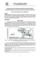
Parameter determination of soil oscillation law using quotient of the relative growth increments of oscillation velocity and reduced distances at “Nepričava“ open pit mine
... of "Nepričava" Open Pit Mine The limestone deposit "Nepričava" is situated at a distance of about 7.0 km west of town of Lajkovac, along the road and railroad Lajkovac - Valjevo, on the left bank of Kolubara River in the nearest vicinity of village of Slovac. The limestone deposit "Nepričava" is ...
... its magnitude, being: the amount of explosive, the distance from the blast site, characteristics of the rock mass and the type of blasting, it is the equation of M. A. Sadovski that is used most commonly. In this paper, the law of Sadovsky is derived using the quotient of the relationship between ...
... plan it, the determination of soil oscillation law is required, with the strike: mine field - facilities to be protected. One of the most commonly used equations is that of M. A. Sadovski defining the law of alteration in the oscillation velocity of the soil depending on the distance, the explosive ...Suzana Lutovac, Sanja Bajić, Marina Ravilić, Radmila Gaćina. "Parameter determination of soil oscillation law using quotient of the relative growth increments of oscillation velocity and reduced distances at “Nepričava“ open pit mine" in Underground Mining Engineering, Belgrade : University of Belgrade, Faculty of Mining and Geology (2015). https://doi.org/10.5937/podrad1526009L
-
Concepts for Improving Machine Learning Based Landslide Assessment
Miloš Marjanović, Mileva Samardžić Petrović, Biljana Abolmasov, Uroš Đurić. "Concepts for Improving Machine Learning Based Landslide Assessment" in Natural Hazards GIS-based Spatial Modeling Using Data Mining Techniques, Advances in Natural and Technological Hazards Research, volume 48, Springer Nature Switzerland AG 2019 (2019). https://doi.org/10.1007/978-3-319-73383-8_2
-
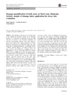
Damage quantification of built stone on Dark Gate (Belgrade, Serbia): sample of damage index application for decay rate evaluation
The Dark Gate is the monument of culture, part of the cultural and historical complex of the Belgrade Fortress. It is constructed of limestone blocks that after 270 years of exposure to environmental conditions and different anthropogenic influences show wide ranges of decay forms. During 2007, detail registration of all built limestone microfacies and weathering forms was done using tools of monument mapping. A correlation scheme ‘‘intensity– damage category’’ was made according to the type, intensity, and distribution of ...... descends from the Upper Town of the fortress, while on the western side River Sava is 50 meters away. According to the type of building material, the gate is a heterogeneous structure. South facade is built entirely of limestone blocks, while the inner part of the gate and the northern facade ...
... related to the destroyed waterproofing layers above the gate. Although the upper part of the gate is more influenced by wind that results in the faster drying process, the lower part of facades is influenced by the groundwater rising up. Additionally, gate position close to the Sava river (only ...
... and 2014, the eastern part of the gate was separated as the zone of the monument that had suffered the heaviest damage. Differ- ences among the values of damage indices showed that the position of the gate is one of the main causes of the present state of stone blocks built in the Dark Gate ...Maja Franković, Nevenka Novaković, Vesna Matović. "Damage quantification of built stone on Dark Gate (Belgrade, Serbia): sample of damage index application for decay rate evaluation" in Environmental Earth Sciences, Springer Science and Business Media LLC (2015). https://doi.org/10.1007/s12665-014-3843-z
-
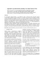
Approach to operational mine planning: Case study Tamnava West
... partings (14 sandstone and 32 clay), clay basement, interburden sandstone and overburden river sediments have been modeled within a stratigraphic section up to 98 m thick. The reason for so detail model lies in the fact that this model is base for coal homogenization process, so it need to represent ...
... Figure 2. Portion of the pit Tamnava West All the boreholes were drilled vertically, but the regional dip of the Tamnava West deposit in average is 3°, the apparent thickness of the intersected coal seams closely approximates the true thickness (except in the western part where intensive ...
... coal is the most important fuel in the generation of electricity, accounting for 65% of the power production 2. This fact is the main reason why production objectives of coal mine and power plant are strongly connected. The power plant owner is interested to know in advance the quality ...Dejan Stevanović, Mirjana Banković, Milica Pešić Georgiadis, Ranka Stanković. "Approach to operational mine planning: Case study Tamnava West" in Tehnika, Beograd : Savez inženjera i tehničara Srbije (2014). https://doi.org/10.5937/tehnika1406952S