Претрага
161 items
-
Elementi retkih zemalja u granatima skarnova Rogozne
Mladenović Dunja, Batoćanin Natalija, Vulić Predrag, Srećković-Batoćanin Danica. "Elementi retkih zemalja u granatima skarnova Rogozne" in Zbornik apstrakata sa 17. Kongresa geologa Srbije-Nacionalni Kongres sa medjunarodnim učešćem, Vrnjačka Banja, 17-20.maj, 2018 1, Beograd:Srpsko geološko društvo (2018): 60-63
-
Јувелирски камен лежишта Рамаћа (Страгари, Србија)
Jovanović Тeodora, Miladinović Zoran, Srećković-Batoćanin Danica, Simić Vladimir. "Јувелирски камен лежишта Рамаћа (Страгари, Србија)" in 17. Конгрес геолога Србије, Врњачка Бања, 17‐20. мај 2018 1, Vrnjačka banja:Srpsko geološko društvo (2018): 369-373
-
Mehanizam formiranja sulfata na odlagalištima polimetaličnog ležišta Rudnik,
Zdravković Alena, Cvetković Vladica, Pačevski Aleksandar, Rosić Aleksandra, Šarić Kristina, Matović Vesna, Erić Suzana, (2018)Zdravković Alena, Cvetković Vladica, Pačevski Aleksandar, Rosić Aleksandra, Šarić Kristina, Matović Vesna, Erić Suzana,. "Mehanizam formiranja sulfata na odlagalištima polimetaličnog ležišta Rudnik," in 17. Kongres geologa Srbije: Zbornik apstrakata (Nacionalni kongres s međunarodnim učešćem), 17-20. Maj, Vrnjačka Banja 1, Beograd:Srpsko geološko društvo (2018): 52-54
-
Three dimensional stability analysis of the Mokra Gora landslide
Ćorić Slobodan, Rakić Dragoslav, Hadži-Niković Gordana, Vlajković Vladan. "Three dimensional stability analysis of the Mokra Gora landslide" in 2nd Regional Symposium on Landslides in the Adriatic-Balkan Region - ReSyLAB 2, Beograd:Rudarsko-geološki fakultet Beograd (2017): 62-65
-
Permanent geodetic monitoring of the Umka Landslide using GNSS techonology and GeoMoss system
Erić Verica, Božić Branko, Pejić Marko, Abolmasov Biljana, Pandžić Jelena. "Permanent geodetic monitoring of the Umka Landslide using GNSS techonology and GeoMoss system" in Abstract book - 2nd Regional Symposium on Landslides in the Adriatic-Balkan Region - 2nd ReSyLAB 2015 1 no. 1, Beograd, Srbija:University of Belgrade, Faculty of Mining and Geology, Belgrade (2015): 39-39
-
Permanent geodetic monitoring of the Umka Landslide using GNSS techonology and GeoMoss system
Erić Verica, Božić Branko, Pejić Marko, Abolmasov Biljana, Pandžić Elena. "Permanent geodetic monitoring of the Umka Landslide using GNSS techonology and GeoMoss system" in Procedings of 2nd Regional Symposium on Landslides in the Adriatic-Balkan Region - 2nd ReSyLAB 2015 1, Beograd:Rudarsko-geološki fakultet Univerziteta u Beogradu (2017): 43-48
-
Sulfati bakra i gvožđa kao produkti raspadanja poliranog uzorka borske rude,
Dabić Predrag, Kovač Sabina, Zdravković Alena, Miloš Sofija, Batoćanin Natalija,. "Sulfati bakra i gvožđa kao produkti raspadanja poliranog uzorka borske rude," in 17. Kongres geologa Srbije: Zbornik apstrakata (Nacionalni kongres s međunarodnim učešćem), 17-20. Maj, Vrnjačka Banja 1, Beograd:Srpsko geološko društvo (2018): 45-47
-
Хидрогеолошки потенцијал карстних масива Озрена и Девице
Саша Стојадиновић, Михаило Шевић, Јаков Андријашевић. "Хидрогеолошки потенцијал карстних масива Озрена и Девице" in XVII Конгрес геолога Србије (Зборник радова XVII српског геолошког конгреса), Врњачка Бања, 17-20.05.2018., Српско геолошко друштво, Београд, Србија (2018)
-
Results of Recent Monitoring Activities on Landslide Umka, Belgrade, Serbia—IPL 181
Biljana Abolmasov, Uroš Đurić, Jovan Popović, Marko Pejić, Mileva Samardžić Petrović, Nenad Brodić (2021)... Abolmasov, Uroš Đurić, Jovan Popović, Marko Pejić, Mileva Samardžić Petrović, Nenad Brodić Дигитални репозиторијум Рударско-геолошког факултета Универзитета у Београду [ДР РГФ] Results of Recent Monitoring Activities on Landslide Umka, Belgrade, Serbia—IPL 181 | Biljana Abolmasov, Uroš Đurić, Jovan ...
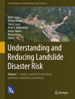
... Structure of the Fifth World Landslide Forum Results of Recent Monitoring Activities on Landslide Umka, Belgrade, Serbia—IPL 181 Biljana Abolmasov, Uroš Đurić, Jovan Popović, Marko Pejić, Mileva Samardžić Petrović, and Nenad Brodić Abstract Results of recent monitoring activities conducted from 2014 ...Biljana Abolmasov, Uroš Đurić, Jovan Popović, Marko Pejić, Mileva Samardžić Petrović, Nenad Brodić. "Results of Recent Monitoring Activities on Landslide Umka, Belgrade, Serbia—IPL 181" in Understanding and Reducing Landslide Disaster Risk. WLF 2020. ICL Contribution to Landslide Disaster Risk Reduction, Springer, Cham (2021). https://doi.org/10.1007/978-3-030-60196-6_14
-
Novi pristup proučavanju tekstura minerala značajnih za istraživanje rudnih ležišta
Aleksandar Pačevski (2022)... Vladimir Simić, Danica Srećković Batoćanin, Nevenka Đerić, Dragana Životić, Rade Jelenković, Aleksandar Kostić, Uroš Đurić, Miloš Marjanović, Alena Zdravković, Suzana Erić, Meri Ganić, Uroš Stojadinović, Katarina Bogićević, Dejan Prelević, Jana Štrbački, Vesna Ristić-Vakanjac, Dušan Polomčić, Vesna ...Aleksandar Pačevski. "Novi pristup proučavanju tekstura minerala značajnih za istraživanje rudnih ležišta" in 18. Kongres geologa Srbije “Geologija rešava probleme” Divčibare, 01-04 jun 2022., Beograd : Srpsko geološko društvo (2022)
-
Application of geophysical and multispectral imagery data for predictive mapping of a complex geo-tectonic unit: a case study of the East Vardar Ophiolite Zone, North-Macedonia
... for predictive mapping of a complex geo-tectonic unit: a case study of the East Vardar Ophiolite Zone, North-Macedonia Filip Arnaut, Dragana Đurić, Uroš Đurić, Mileva Samardžić-Petrović, Igor Peshevski Дигитални репозиторијум Рударско-геолошког факултета Универзитета у Београду [ДР РГФ] Application ...
... for predictive mapping of a complex geo-tectonic unit: a case study of the East Vardar Ophiolite Zone, North-Macedonia | Filip Arnaut, Dragana Đurić, Uroš Đurić, Mileva Samardžić- Petrović, Igor Peshevski | Earth Science Informatics | 2024 | | 10.1007/s12145-024-01243-4 http://dr.rgf.bg.ac.rs/s/repo ...
... predictive mapping of a complex geo-tectonic unit: a case study ofthe East Vardar Ophiolite Zone, North-Macedonia Filip Arnaut! · Dragana Đurić* · Uroš Đurićš · Mileva Samardžić-Petrović* · Igor Peshevski“ Received: 12 July 2023 / Accepted: 28 January 2024 / Published online: 20 February 2024 The ...Filip Arnaut, Dragana Đurić, Uroš Đurić, Mileva Samardžić-Petrović, Igor Peshevski. "Application of geophysical and multispectral imagery data for predictive mapping of a complex geo-tectonic unit: a case study of the East Vardar Ophiolite Zone, North-Macedonia" in Earth Science Informatics, Springer Science and Business Media LLC (2024). https://doi.org/10.1007/s12145-024-01243-4
-
Increasing the Local Road Network Resilience from Natural Hazards in Municipalities in Serbia
Biljana Abolmasov, Miloš Marjanović, Ranka Stanković, Uroš Đurić, Nikola Vulović. "Increasing the Local Road Network Resilience from Natural Hazards in Municipalities in Serbia" in Progress in Landslide Research and Technology, Volume 3, Issue 1, Springer Cham. (2024). https://doi.org/https://doi.org/10.1007/978-3-031-55120-8_22
-
Tectonic evolution of the Vršac Mts. (NE Serbia): Inferences from field kinematic and microstructural investigations
The Vršac Mts. in NE Serbia represent the key area to investigate structural relations between the Northern Serbo-Macedonian Subunit and Supragetic Unit of the Dacia Mega-Unit. The geodynamic events during the Variscan orogeny in the Late Paleozoic colligated the two units and led to their metamorphic differentiation. The Late Cretaceous extension exhumed the medium-grade Serbo-Macedonian metamorphic rocks and structurally juxtaposed them against the low-grade metamorphosed basement of the Supragetic Unit along an E-dipping shear zone, which outcrops in the ...severna srpsko-makedonska subjedinica, supragetikum, kinematska analiza, multifazna ekstenzionalna deformacija... previous studies in the area and elsewhere in the Serbo-Macedonian Unit (Matenco & Radivo- jević 2012; Antić et al. 2016a, b; Erak et al. 2017; Stojadinovic et al. 2017) in order to constrain the timing and amount of the Vršac Mts. recent tectonic uplift and define the tectonic processes responsible ...
... Supplement S1 “Satellite image of Eger – Tufakőbánya site” at http://geologicacarpathica.com/data/files/supplements/GC-72-4-Kohut_Ta- bleS1.xlsx 396 STOJADINOVIC, KRSTEKANIĆ, KOSTIĆ, RUŽIĆ and LUKOVIĆ GEOLOGICA CARPATHICA, 2021, 72, 5, 395–405 the metamorphism they underwent (Fig. 2). The subsequent Alpine ...
... metadolerites Q - quarzites Sm - micaschists G - gneisses Mi - migmatites - granitesγ M - marbles Q - quartzites A - amphibolites 398 STOJADINOVIC, KRSTEKANIĆ, KOSTIĆ, RUŽIĆ and LUKOVIĆ GEOLOGICA CARPATHICA, 2021, 72, 5, 395–405 deposition that starts in Badenian and reaches its peak in ...Uroš Stojadinović, Nemanja Krstekanić, Bojan Kostić, Marija Ružić, Aleksa Luković . "Tectonic evolution of the Vršac Mts. (NE Serbia): Inferences from field kinematic and microstructural investigations" in Geologica Carpathica, Central Library of the Slovak Academy of Sciences (2021). https://doi.org/https://doi.org/10.31577/GeolCarp.72.5.3
-
Jeleč grad- još nepriznati objekat geonasleđa
Остаци средњовековног града Јелеча на једном од врхова планине Рогозне (1262 m), по неким веровањима представљаju купу угашеног вулкана. Рогозна je позната по појавама скарновске Cu–Au минерализације, а трагови рударске активности и важних путева још од античких времена и даље постоје у непосредној околини. О томе сведочи и османски назив за Рогозну: Gümüş Dağ (Сребрна планина). Време изградње Јелеча је непознато. Постоје индиције да је постојао још у 6. веку, али се помиње први пут средином 12. века. Поуздан податак ...Marija Radisavljević, Danica Srećković Batoćanin, Vladan Vidosavljević, Irena Kajtez. "Jeleč grad- još nepriznati objekat geonasleđa" in Zbornik apstrakata, 212. 18. Kongres geologa Srbije "Geologija rešava probleme", Divčibare, 01-04 jun 2022, Srpsko geološko društvo (2022)
-
Preliminary regional landslide susceptibility assessment using limited data
Igor Peshevski, Milorad Jovanovski, Biljana Abolmasov, Jovan Papic, Uroš Đurić, Miloš Marjanović, Ubydul Haque, Natasha Nedelkovska (2019)In this paper a heuristic approach for preliminary regional landslide susceptibility assessment using limited amount of data is presented. It is called arbitrary polynomial method and takes into account 5 landslide conditioning parameters: lithology, slope inclination, average annual rainfall, land use and maximum expected seismic intensity. According to the method, in the first stage, a gradation is performed for each of the carefully selected conditioning parameters by assigning so called rating points to the grid cells on which the ...... 04:19:39 Preliminary regional landslide susceptibility assessment using limited data Igor Peshevski, Milorad Jovanovski, Biljana Abolmasov, Jovan Papic, Uroš Đurić, Miloš Marjanović, Ubydul Haque, Natasha Nedelkovska Дигитални репозиторијум Рударско-геолошког факултета Универзитета у Београду [ДР РГФ] ...
... РГФ] Preliminary regional landslide susceptibility assessment using limited data | Igor Peshevski, Milorad Jovanovski, Biljana Abolmasov, Jovan Papic, Uroš Đurić, Miloš Marjanović, Ubydul Haque, Natasha Nedelkovska | Geologica Croatica | 2019 | | 10.4154/gc.2019.03 http://dr.rgf.bg.ac.rs/s/repo/item/0005129 ...
... Preliminary regional landslide susceptibility assessment using limited data Igor Peshevski1, Milorad Jovanovski1, Biljana Abolmasov2, Jovan Papic1, Uroš Đurić3, Miloš Marjanović2, Ubydul Haque4 and Natasha Nedelkovska5 1 University Ss. Cyril and Methodius, Faculty of Civil Engineering, Blvd. Partizanski ...Igor Peshevski, Milorad Jovanovski, Biljana Abolmasov, Jovan Papic, Uroš Đurić, Miloš Marjanović, Ubydul Haque, Natasha Nedelkovska. "Preliminary regional landslide susceptibility assessment using limited data" in Geologica Croatica , Croatian Geological Society (2019). https://doi.org/10.4154/gc.2019.03
-
Primena metoda podzemnog otkopavanja sa očuvanjem površine terena
Uroš Mirković (2024)Tema ovog diplomskog rada je primena metoda podzemnog otkopavanja sa očuvanjem površine terena, sa posebnim osvrtom na metodu otkopavanja uz zasipavanje pasta zasipima. Ova metoda omogućava efikasan eksploatacioni proces u podzemnim rudnicima, uz minimalne uticaje na površinu, čime se smanjuju deformacije i sleganja terena iznad eksploatacionih radova. Pasta zasipi, koji se sastoje od mešavine jalovine, vode i cementa, koriste se za popunjavanje ispražnjenih prostorija nakon otkopavanja, čime se obezbeđuje stabilnost okolnih stena i smanjuje rizik od urušavanja. Ovaj rad ...... Primena metoda podzemnog otkopavanja sa očuvanjem površine terena Uroš Mirković Дигитални репозиторијум Рударско-геолошког факултета Универзитета у Београду [ДР РГФ] Primena metoda podzemnog otkopavanja sa očuvanjem površine terena | Uroš Mirković | | 2024 | | http://dr.rgf.bg.ac.rs/s/repo/item/0008919 ...
... geološki fakultet Završni rad Osnovne akademske studije Primena metoda podzemnog otkopavanja sa očuvanjem površine terena Kandidat: Mentor: Uroš Mirković R68/19 prof.dr Branko Gluščević Komisija: 1.Dr Branko Gluščević, redovni profesor, mentor Rudarsko-geološki fakultet, Beograd 2.Dr ...Uroš Mirković . Primena metoda podzemnog otkopavanja sa očuvanjem površine terena, 2024
-
XRD dertermination od hydrothermal phases related to epithermal mineralization in the Čukaru Peki deposit
Dragana Bosić, Vladica Cvetković, Miodrag Banješević, Kristina Šarić. "XRD dertermination od hydrothermal phases related to epithermal mineralization in the Čukaru Peki deposit" in V Congress of Geologists of Republic of Macedonia ": “Geology in a changing world”, Makedonsko geološko društvo (2024)
-
Concepts for Improving Machine Learning Based Landslide Assessment
Miloš Marjanović, Mileva Samardžić Petrović, Biljana Abolmasov, Uroš Đurić. "Concepts for Improving Machine Learning Based Landslide Assessment" in Natural Hazards GIS-based Spatial Modeling Using Data Mining Techniques, Advances in Natural and Technological Hazards Research, volume 48, Springer Nature Switzerland AG 2019 (2019). https://doi.org/10.1007/978-3-319-73383-8_2
-
Machine learning based landslide assessment of the Belgrade metropolitan area: Pixel resolution effects and a cross-scaling concept
Improvements of Machine Learning-based landslide prediction models can be made by optimizing scale, customizing training samples to provide sets with the best examples, feature selection, etc. Herein, a novel approach, named Cross-Scaling, is proposed that includes the mixing of training and testing set resolutions. Hypothetically, training on a coarser resolution dataset and testing the model on a finer resolution should help the algorithm to better generalize ambiguous examples of landslide classes and yield fewer over/underestimations in the model. This ...Uroš Đurić, Miloš Marjanović, Zoran Radić, Biljana Abolmasov. " Machine learning based landslide assessment of the Belgrade metropolitan area: Pixel resolution effects and a cross-scaling concept" in Engineering Geology , Elsevier (2019). https://doi.org/10.1016/j.enggeo.2019.05.007
-
Multihazard Exposure Assessment on the Valjevo City Road Network
Miloš Marjanović, Biljana Abolmasov, Svetozar Milenković, Uroš Đurić, Jelka Krušić, Mileva Samardžić Petrović (2019)Miloš Marjanović, Biljana Abolmasov, Svetozar Milenković, Uroš Đurić, Jelka Krušić, Mileva Samardžić Petrović. "Multihazard Exposure Assessment on the Valjevo City Road Network" in Spatial Modeling in GIS and R for Earth and Environmental Sciences, Elsevier Inc (2019). https://doi.org/10.1016/B978-0-12-815226-3.00031-4.


